Home
World
NEW
Premium
Shop
Trails
Articles
Help and support
Français
English
Nederlands
Español
Italiano
Deutsch
Log in
Home
World
Premium
Shop
Trails
Articles
Help and support
SityTrail
>
Points of interest
>
GCW7DM
SityTrail
>
Points of interest
>
GCW7DM
GCW7DM
Description
Le Fort du Saint Eynard by mic
Photos
GCW7DM can be discovered in the following trails...
tracegps
Mont-Jovet depuis La Cour
Walking
Difficult
(1)
Bozel, Auvergne-Rhône-Alpes, Savoy, France
13.5 km | 27 km-effort
6h 0min
Yes
tracegps
User
©
OpenStreetMap
contributors
Positioning
Country:
France
Region :
Auvergne-Rhône-Alpes
Department/Province :
Isère
Municipality :
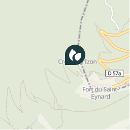
Corenc
Location:
Unknown
Positioning
45.2362 / 5.759583
Creation date :
2018-04-09 12:21:45.417
Updated on
2018-04-09 12:21:45.417
(0 Reviews)
Comments
Please log in to post a review or rate the element
Points of interest nearby
tracegps
GCW7DM
CORENC
tracegps
GCW7DM
CORENC
tracegps
GCW7DM
CORENC
tracegps
GCW7DM
CORENC
tracegps
GCW7DM
CORENC
tracegps
GCW7DM
CORENC
tracegps
GCW7DM
CORENC
tracegps
GCW7DM
CORENC
Close
My subscriptions