Home
World
NEW
Premium
Shop
Trails
Articles
Help and support
Français
English
Nederlands
Español
Italiano
Deutsch
Log in
Home
World
Premium
Shop
Trails
Articles
Help and support
SityTrail
>
Points of interest
>
GCXZTA
SityTrail
>
Points of interest
>
GCXZTA
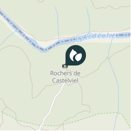
GCXZTA
Description
Rochers de Castelviel by buckf
Photos
GCXZTA can be discovered in the following trails...
tracegps
Crêt Coquet
Walking
Medium
(3)
Hautecour, Auvergne-Rhône-Alpes, Savoy, France
6.5 km | 9.6 km-effort
3h 30min
Yes
tracegps
User
©
OpenStreetMap
contributors
Positioning
Country:
France
Region :
Occitania
Department/Province :
Gard
Municipality :
Aiguèze
Location:
Unknown
Positioning
44.3216 / 4.5348
Creation date :
2018-04-09 12:17:43.756
Updated on
2018-04-09 12:17:43.756
(0 Reviews)
Comments
Please log in to post a review or rate the element
Points of interest nearby
tracegps
GCXZTA
AIGUÈZE
tracegps
GCXZTA
AIGUÈZE
tracegps
GCXZTA
AIGUÈZE
tracegps
GCXZTA
AIGUÈZE
kephas
Point 6
BIDON
kephas
Point 5
BIDON
tracegps
GCWW7W
BIDON
tracegps
GCWW7W
BIDON
Close
My subscriptions