Home
World
NEW
Premium
Shop
Trails
Articles
Help and support
Français
English
Nederlands
Español
Italiano
Deutsch
Log in
Home
World
Premium
Shop
Trails
Articles
Help and support
SityTrail
>
Points of interest
>
GCYG4Y
SityTrail
>
Points of interest
>
GCYG4Y
GCYG4Y
Description
Col de la Fausse by Rockley, T
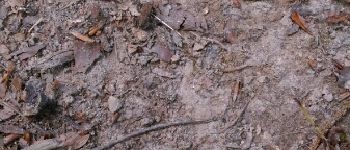
Photos
GCYG4Y can be discovered in the following trails...
tracegps
Crêt Coquet
Walking
Medium
(3)
Hautecour, Auvergne-Rhône-Alpes, Savoy, France
6.5 km | 9.6 km-effort
3h 30min
Yes
tracegps
User
©
OpenStreetMap
contributors
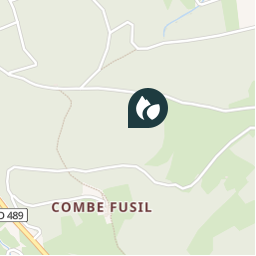
Positioning
Country:
France
Region :
Auvergne-Rhône-Alpes
Department/Province :
Rhône
Municipality :
Vaugneray
Location:
Vaugneray
Positioning
45.73035 / 4.632367
Creation date :
2018-04-09 12:14:50.386
Updated on
2018-04-09 12:14:50.386
(0 Reviews)
Comments
Please log in to post a review or rate the element
Points of interest nearby
tracegps
GCYG4Y
VAUGNERAY
tracegps
GCYG4Y
VAUGNERAY
tracegps
GCYG4Y
VAUGNERAY
tracegps
GCYG4Y
VAUGNERAY
tracegps
GCYG4Y
VAUGNERAY
Trotte-menu
Traversée des bébés crapaud...
VAUGNERAY
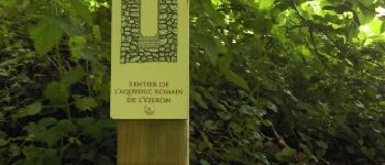
Trotte-menu
sentier aqueduc romain terr...
VAUGNERAY
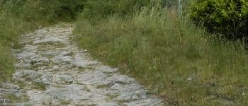
Trotte-menu
Chemin en pierre
VAUGNERAY
Close
My subscriptions