Home
World
NEW
Premium
Shop
Trails
Articles
Help and support
Français
English
Nederlands
Español
Italiano
Deutsch
Log in
Home
World
Premium
Shop
Trails
Articles
Help and support
SityTrail
>
Points of interest
>
GCJKK3
SityTrail
>
Points of interest
>
GCJKK3
GCJKK3
Description
Col Du Mont Cenis by waynerpra
Photos
GCJKK3 can be discovered in the following trails...
tracegps
Lac-Bleu depuis Méribel-Altiport
Walking
Difficult
(1)
Les Allues, Auvergne-Rhône-Alpes, Savoy, France
10 km | 18.1 km-effort
4h 30min
Yes
tracegps
User
©
OpenStreetMap
contributors
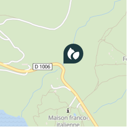
Positioning
Country:
France
Region :
Auvergne-Rhône-Alpes
Department/Province :
Savoy
Municipality :
Val-Cenis
Location:
Lanslebourg-Mont-Cenis
Positioning
45.24345 / 6.94925
Creation date :
2018-04-09 12:18:48.816
Updated on
2018-04-09 12:18:48.816
(0 Reviews)
Comments
Please log in to post a review or rate the element
Points of interest nearby
tracegps
GCJKK3
VAL-CENIS
tracegps
GCJKK3
VAL-CENIS
tracegps
GCJKK3
VAL-CENIS
tracegps
GCJKK3
VAL-CENIS
tracegps
GCJKK3
VAL-CENIS
tracegps
GCJKK3
VAL-CENIS
tracegps
GCJKK3
VAL-CENIS
tracegps
GCJKK3
VAL-CENIS
Close
My subscriptions