Home
World
NEW
Premium
Shop
Trails
Articles
Help and support
Français
English
Nederlands
Español
Italiano
Deutsch
Log in
Home
World
Premium
Shop
Trails
Articles
Help and support
SityTrail
>
Points of interest
>
aller
SityTrail
>
Points of interest
>
aller
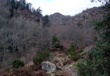
aller
Description
Chemin
Photos
aller can be discovered in the following trails...
tracegps
Autour de Randol - Saint Saturnin
Walking
Medium
(1)
Saint-Saturnin, Auvergne-Rhône-Alpes, Puy-de-Dôme, France
17.4 km | 23 km-effort
4h 30min
Yes
tracegps
User
©
OpenStreetMap
contributors
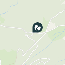
Positioning
Country:
France
Region :
Auvergne-Rhône-Alpes
Department/Province :
Puy-de-Dôme
Municipality :
Saint-Saturnin
Location:
Unknown
Positioning
45.6554675 / 3.0655074
Creation date :
2018-04-09 11:51:44.551
Updated on
2018-04-09 11:51:44.551
(0 Reviews)
Comments
Please log in to post a review or rate the element
Points of interest nearby
tracegps
retour
SAINT-SATURNIN
tracegps
départ
SAINT-SATURNIN
loursblanc
km 13
SAINT-SATURNIN
tracegps
départ
SAINT-SATURNIN
tracegps
Dolmen
COURNOLS
tracegps
point de vue
OLLOIX
force
Point 2
AYDAT
loursblanc
km 8,5
COURNOLS
Close
My subscriptions