Point of interest Saint-Genès-Champanelle - 4 - Photo

4

Description

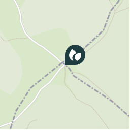
Rester à droite, (plus loin sur le plateau, point de vue sur le Sancy). Négliger les chemins à droite et à gauche, le chemin devient route goudronnée. Poursuivre jusqu'au carrefour en T. Tourner à gauche (à droite accès à la chapelle de Recoleine). Descendre jusqu'à la RN 89 et passer sous la route.

Photos

4 can be discovered in the following trails...
Trail Walking Orcines - Boucle des Dômes - Photo
Walking
LoloGrem

Walking

Difficult
Orcines, Auvergne-Rhône-Alpes, Puy-de-Dôme, France
49 km | 67 km-effort
14h 0min
Yes
 LoloGrem
LoloGrem

User

© OpenStreetMap contributors

Positioning

Country:
France
Region :
Auvergne-Rhône-Alpes
Department/Province :
Puy-de-Dôme
Municipality :
Saint-Genès-Champanelle
Location:
Unknown
Creation date :
2018-04-12 01:34:02.436
Updated on
2018-04-12 01:34:02.436

(0 Reviews)


Points of interest nearby

Point of interest Saint-Genès-Champanelle - 4 - Photo
tony63000
SAINT-GENÈS-CHAMPANELLE 
Point of interest Saint-Genès-Champanelle - GC43GW5 - Photo
adupuped
SAINT-GENÈS-CHAMPANELLE 
Point of interest Aydat - GC34EYW - Photo
adupuped
AYDAT 
Point of interest Nébouzat - 5 - Photo
tony63000
NÉBOUZAT 
Point of interest Nébouzat - 5 - Photo
LoloGrem
NÉBOUZAT 
Point of interest Saint-Genès-Champanelle - GC27EAA - Photo
adupuped
SAINT-GENÈS-CHAMPANELLE 
Point of interest Aydat - GC34P0Y - Photo
adupuped
AYDAT 
Point of interest Aydat - GC2TNKW - Photo
adupuped
AYDAT 


Close
My subscriptions