Point of interest Orcines - 2 - Photo

2

Description

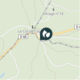
Monter jusqu'à l’aire de camping-car. Suivre sur la route les plaques directionnelles jaunes en direction du col de Ceyssat. Prendre le premier grand chemin forestier à gauche. Traverser la route D 68 et continuer tout droit. Ignorer le premier chemin de droite et au croisement en T prendre à droite une large voie forestière empierrée jusqu'au col de Ceyssat.

Photos

2 can be discovered in the following trails...
Trail Other activity Orcines - Sans titre - Photo
Other activity
tony63000

Other activity

Very easy
Orcines, Auvergne-Rhône-Alpes, Puy-de-Dôme, France
49 km | 67 km-effort
Unknown
Yes
© OpenStreetMap contributors

Positioning

Country:
France
Region :
Auvergne-Rhône-Alpes
Department/Province :
Puy-de-Dôme
Municipality :
Orcines
Location:
Unknown
Creation date :
2018-04-12 08:54:11.69
Updated on
2018-04-12 08:54:11.69

(0 Reviews)


Points of interest nearby

Point of interest Orcines - 2 - Photo
LoloGrem
ORCINES 
Point of interest Orcines - départ - Photo
tracegps
ORCINES 
Point of interest Orcines - départ - Photo
tracegps
ORCINES 
Point of interest Saint-Genès-Champanelle - col de ceyssat - Photo
lepetitponey
SAINT-GENÈS-CHAMPANELLE 
Point of interest Orcines - Col de Ceyssat - Photo
lepetitponey
Point of interest Saint-Genès-Champanelle - Col de ceyssat - Photo
lepetitponey
SAINT-GENÈS-CHAMPANELLE 
Point of interest Ceyssat - GC49ZZ2 - Photo
adupuped
CEYSSAT 
Point of interest Ceyssat - Point 3 - Photo
cirilb
CEYSSAT 


Close
My subscriptions