Point of interest Saint-Michel - Table d'orientation - Photo

Table d'orientation

Description

Photos

Table d'orientation can be discovered in the following trails...
Trail Walking Saint-Jean-Pied-de-Port - C3.2 St Jean - Roncevaux - Photo
Walking
aja

Walking

Difficult
(1)
Saint-Jean-Pied-de-Port, New Aquitaine, Pyrénées-Atlantiques, France
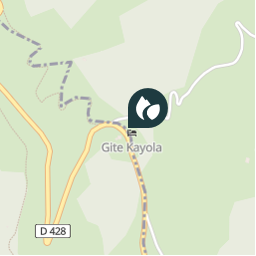
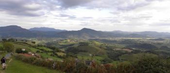
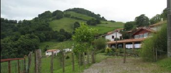
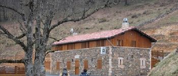
25 km | 41 km-effort
8h 56min
No
 aja
aja

User

© OpenStreetMap contributors

Positioning

Country:
France
Region :
New Aquitaine
Department/Province :
Pyrénées-Atlantiques
Municipality :
Saint-Michel
Location:
Unknown
Creation date :
2018-04-10 13:26:51.385
Updated on
2018-04-10 13:26:51.385

(0 Reviews)

Viewpoints - panoramas

Points of interest nearby

Point of interest Saint-Michel - Hounto - Photo
Ardeiserois
SAINT-MICHEL 
Point of interest Saint-Michel - Pad - Photo
gpstracks
SAINT-MICHEL 
Point of interest Saint-Michel - Honto - Photo
aja
SAINT-MICHEL 
Point of interest Uhart-Cize - Refuge d'Orisson - Photo
aja
UHART-CIZE 
Point of interest Uhart-Cize - Auberge - Photo
gpstracks
UHART-CIZE 
Point of interest Saint-Michel - 982 - Photo
YTHIER
SAINT-MICHEL 
Point of interest Uhart-Cize - Tournan du carosse - Photo
aja
UHART-CIZE 
Point of interest Estérençuby - 981 - Photo
YTHIER
ESTÉRENÇUBY 


Close
My subscriptions