Point of interest Sivry-Rance -

"El Fosse al Gade"

Description

"El Fosse al Gade" (The Goat Ditch), supplied with water by the Thure, which is widest at this spot. This waterfall is named after a legend. The flood defence structure once served to regulate the water supply to the grain mill

that stood upstream of the waterway.

The dyke, with its limestone dam bridge, is dated 1744. The Etang du Mont Rosé (Mount Rosé Lake) was once known as the Etang du Moulin (Mill Lake).

Photos

"El Fosse al Gade" can be discovered in the following trails...
Trail Walking Sivry-Rance - Sivry-Rance (02) - Mont Rosé (Mount Rosé) Walk - Photo
Walking
GUIDE+

Walking

Medium
(1)
Sivry-Rance, Wallonia, Hainaut, Belgium
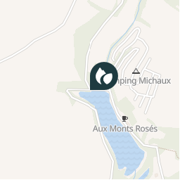
6.7 km | 7.9 km-effort
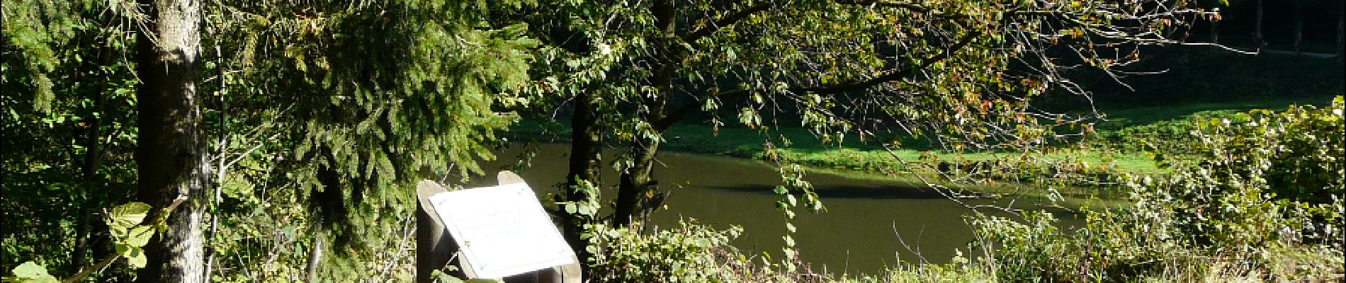
1h 45min
Yes

Randonnées au coeur d'une nature préservée GUIDE+

© OpenStreetMap contributors

Positioning

Country:
Belgium
Region :
Wallonia
Department/Province :
Hainaut
Municipality :
Sivry-Rance
Location:
Grandrieu
Creation date :
2018-04-09 13:16:44.667
Updated on
2018-04-09 13:16:44.667

(0 Reviews)


Points of interest nearby

Point of interest Sivry-Rance - «El Fosse al Gade» - Photo
La Forêt du Pays de Chimay
Point of interest Sivry-Rance - the source of the Tortumasse stream - Photo
La Forêt du Pays de Chimay
Point of interest Sivry-Rance - Fontaine du Salinin (Salinin Spring) - Photo
La Forêt du Pays de Chimay
Point of interest Sivry-Rance - ‘El pâture du Nespeli’ (Néflier pasture). - Photo
La Forêt du Pays de Chimay
Point of interest Sivry-Rance - Old Farm - Photo
La Forêt du Pays de Chimay
SIVRY-RANCE 
Point of interest Sivry-Rance - The Route du Moulard (Moulard Road) - Photo
La Forêt du Pays de Chimay
Point of interest Sivry-Rance - Viewpoint - Photo
La Forêt du Pays de Chimay
SIVRY-RANCE 
Point of interest Sivry-Rance - Church - Photo
La Forêt du Pays de Chimay
SIVRY-RANCE 


Close
My subscriptions