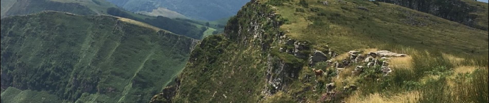
crêtes d'Iparla depuis Urdos

so.duchateau
User
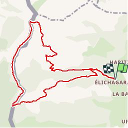

Length
11.7 km

Max alt
1036 m

Uphill gradient
799 m
Km-Effort
22 km

Min alt
301 m

Downhill gradient
798 m
Boucle
Yes
Creation date :
2019-01-15 12:56:26.162
Updated on :
2019-01-15 12:56:26.162
5h17
Difficulty : Difficult

FREE GPS app for hiking
 SityTrail
IGN / Geographical institutes
SityTrail Plus
The world is yours!
About
Trail Walking of 11.7 km to be discovered at New Aquitaine, Pyrénées-Atlantiques, Saint-Étienne-de-Baïgorry. This trail is proposed by so.duchateau.
Description
Très très belle Rando à faire obligatoirement dans le sens réalisé sous peine de gros vertige à la descente!
Photos


Positioning
Country:
France
Region :
New Aquitaine
Department/Province :
Pyrénées-Atlantiques
Municipality :
Saint-Étienne-de-Baïgorry
Location:
Unknown
Start:(Dec)
Start:(UTM)
634095 ; 4786304 (30T) N.
Comments