


CHAMPAGNY-LA-VANOISE (73).

AndreLACOMBE
User

Length
12.1 km

Max alt
1937 m

Uphill gradient
598 m
Km-Effort
20 km

Min alt
1441 m

Downhill gradient
598 m
Boucle
Yes
Creation date :
2019-01-15 13:06:45.435
Updated on :
2019-01-15 13:06:45.435
6h53
Difficulty : Easy

FREE GPS app for hiking
 SityTrail
IGN / Geographical institutes
SityTrail Plus
The world is yours!
About
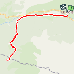
Trail Walking of 12.1 km to be discovered at Auvergne-Rhône-Alpes, Savoy, Champagny-en-Vanoise. This trail is proposed by AndreLACOMBE.
Description
Au départ de Champagny-le-Haut "Le Bois", la Tour du Merle et retour.
Positioning
Country:
France
Region :
Auvergne-Rhône-Alpes
Department/Province :
Savoy
Municipality :
Champagny-en-Vanoise
Location:
Unknown
Start:(Dec)
Start:(UTM)
323629 ; 5036405 (32T) N.
Comments