![](/images/other/stat-length.png)
Savoy, Auvergne-Rhône-Alpes: Best trails, routes and walks
Savoy: Discover the best trails: 8,382 hiking trails, 983 bike and mountain-bike routes and 214 equestrian circuits. All these trails, routes and outdoor activities are available in our SityTrail applications for smartphones and tablets.
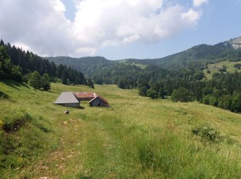
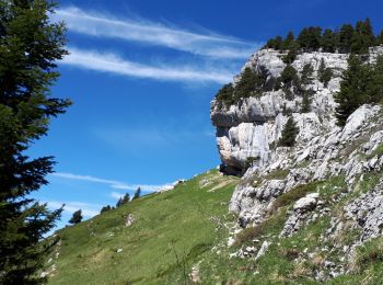
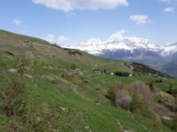
The best trails (11722)
![Trail Walking Apremont - Mont Joigny, pte de la Georgat, la Lentille, le GD Carroz - Photo](https://media.geolcdn.com/t/350/260/ext.jpg?maxdim=2&url=https%3A%2F%2Fmedia.geolcdn.com%2Ff%2F34a799f3-15e1-4e29-b39c-0c906d59ce42.jpg)
![Walking Walking](https://static1.geolcdn.com/sitytour/trail-icons/101.png)
Km
Walking
![](/images/other/stat-length.png)
![](https://static1.geolcdn.com/siteimages/upload/files/1508320355ic_sort_den_pos_24dp.png)
![](https://static1.geolcdn.com/siteimages/upload/files/1508320355ic_sort_den_neg_24dp.png)
![](https://static1.geolcdn.com/siteimages/upload/files/16400158638029165_repeat_loop_refresh_sync_direction_icon.png)
![Trail Walking Val-d'Isère - rocher du Charvet - Photo](https://media.geolcdn.com/t/350/260/ext.jpg?maxdim=2&url=https%3A%2F%2Fmedia.geolcdn.com%2Ff%2F695e5e9f-e8dc-4cf9-b576-ab38f18a42af.jpg)
![Walking Walking](https://static1.geolcdn.com/sitytour/trail-icons/101.png)
Km
Walking
![](/images/other/stat-length.png)
![](https://static1.geolcdn.com/siteimages/upload/files/1508320355ic_sort_den_pos_24dp.png)
![](https://static1.geolcdn.com/siteimages/upload/files/1508320355ic_sort_den_neg_24dp.png)
![](https://static1.geolcdn.com/siteimages/upload/files/16400158638029165_repeat_loop_refresh_sync_direction_icon.png)
![Trail Walking Tignes - la pointe de Picheru - Photo](https://media.geolcdn.com/t/350/260/ext.jpg?maxdim=2&url=https%3A%2F%2Fservices.sitytrail.com%2FGeolivesWS%2FDownloadMedia.ashx%3FTrailID%3D813856%26Media%3Dfix__20170820100255.jpg)
![Walking Walking](https://static1.geolcdn.com/sitytour/trail-icons/101.png)
Km
Walking
![](/images/other/stat-length.png)
![](https://static1.geolcdn.com/siteimages/upload/files/1508320355ic_sort_den_pos_24dp.png)
![](https://static1.geolcdn.com/siteimages/upload/files/1508320355ic_sort_den_neg_24dp.png)
![](https://static1.geolcdn.com/siteimages/upload/files/16400158638029165_repeat_loop_refresh_sync_direction_icon.png)
![Trail Walking Tignes - l'aiguille perçée - Photo](https://media.geolcdn.com/t/350/260/ext.jpg?maxdim=2&url=https%3A%2F%2Fservices.sitytrail.com%2FGeolivesWS%2FDownloadMedia.ashx%3FTrailID%3D337133%26Media%3Dfix__20140820112508.jpg)
![Walking Walking](https://static1.geolcdn.com/sitytour/trail-icons/101.png)
Km
Walking
![](/images/other/stat-length.png)
![](https://static1.geolcdn.com/siteimages/upload/files/1508320355ic_sort_den_pos_24dp.png)
![](https://static1.geolcdn.com/siteimages/upload/files/1508320355ic_sort_den_neg_24dp.png)
![](https://static1.geolcdn.com/siteimages/upload/files/16400158638029165_repeat_loop_refresh_sync_direction_icon.png)
![Trail Walking Tignes - lacs du saut et de la sassiere - Photo](https://media.geolcdn.com/t/350/260/ext.jpg?maxdim=2&url=https%3A%2F%2Fservices.sitytrail.com%2FGeolivesWS%2FDownloadMedia.ashx%3FTrailID%3D336967%26Media%3D637041f5-cff1-4406-a972-10b75ef104dd.JPG)
![Walking Walking](https://static1.geolcdn.com/sitytour/trail-icons/101.png)
Km
Walking
![](/images/other/stat-length.png)
![](https://static1.geolcdn.com/siteimages/upload/files/1508320355ic_sort_den_pos_24dp.png)
![](https://static1.geolcdn.com/siteimages/upload/files/1508320355ic_sort_den_neg_24dp.png)
![](https://static1.geolcdn.com/siteimages/upload/files/16400158638029165_repeat_loop_refresh_sync_direction_icon.png)
![Trail Walking Saint-Martin-de-la-Porte - Pointe de la Masse-2023-09-24 - Photo](https://media.geolcdn.com/t/350/260/ext.jpg?maxdim=2&url=https%3A%2F%2Fmedia.geolcdn.com%2Ff%2F4b3cf49d-3183-4ff4-940d-b53cd4b7fc6c.jpg)
![Walking Walking](https://static1.geolcdn.com/sitytour/trail-icons/101.png)
Km
Walking
![](/images/other/stat-length.png)
![](https://static1.geolcdn.com/siteimages/upload/files/1508320355ic_sort_den_pos_24dp.png)
![](https://static1.geolcdn.com/siteimages/upload/files/1508320355ic_sort_den_neg_24dp.png)
![](https://static1.geolcdn.com/siteimages/upload/files/16400158638029165_repeat_loop_refresh_sync_direction_icon.png)
![Trail Walking Landry - Landry... Circuit des Poussettes - Photo](https://media.geolcdn.com/t/350/260/ext.jpg?maxdim=2&url=https%3A%2F%2Fmedia.geolcdn.com%2Ff%2F7036f5a0-5897-408b-aec5-74b6e9af163d.jpeg)
![Walking Walking](https://static1.geolcdn.com/sitytour/trail-icons/101.png)
Km
Walking
![](/images/other/stat-length.png)
![](https://static1.geolcdn.com/siteimages/upload/files/1508320355ic_sort_den_pos_24dp.png)
![](https://static1.geolcdn.com/siteimages/upload/files/1508320355ic_sort_den_neg_24dp.png)
![](https://static1.geolcdn.com/siteimages/upload/files/16400158638029165_repeat_loop_refresh_sync_direction_icon.png)
![Trail Walking Saint-Colomban-des-Villards - Lac de l'âne départ pont du Rieu-claret - Photo](https://media.geolcdn.com/t/350/260/ext.jpg?maxdim=2&url=https%3A%2F%2Fmedia.geolcdn.com%2Ff%2Fda43fabe-f484-4e32-b936-8fd9ca7d3840.jpg)
![Walking Walking](https://static1.geolcdn.com/sitytour/trail-icons/101.png)
Km
Walking
![](/images/other/stat-length.png)
![](https://static1.geolcdn.com/siteimages/upload/files/1508320355ic_sort_den_pos_24dp.png)
![](https://static1.geolcdn.com/siteimages/upload/files/1508320355ic_sort_den_neg_24dp.png)
![](https://static1.geolcdn.com/siteimages/upload/files/16400158638029165_repeat_loop_refresh_sync_direction_icon.png)
![Trail Walking Hauteluce - sous Bisanne au lac des Saisies - Photo](https://media.geolcdn.com/t/350/260/ext.jpg?maxdim=2&url=https%3A%2F%2Fmedia.geolcdn.com%2Ff%2F37326f22-0206-4f0e-b1e9-16790c9e91ab.jpg)
![Walking Walking](https://static1.geolcdn.com/sitytour/trail-icons/101.png)
Km
Walking
![](/images/other/stat-length.png)
![](https://static1.geolcdn.com/siteimages/upload/files/1508320355ic_sort_den_pos_24dp.png)
![](https://static1.geolcdn.com/siteimages/upload/files/1508320355ic_sort_den_neg_24dp.png)
![](https://static1.geolcdn.com/siteimages/upload/files/16400158638029165_repeat_loop_refresh_sync_direction_icon.png)
![Trail Walking Séez - hospice petit saint Bernard . lac dans fond . la parciere . hospice - Photo](https://media.geolcdn.com/t/350/260/ext.jpg?maxdim=2&url=https%3A%2F%2Fmedia.geolcdn.com%2Ff%2Fcb23f3b1-848c-4f41-9bcb-bf02580d2bd3.jpg)
![Walking Walking](https://static1.geolcdn.com/sitytour/trail-icons/101.png)
Km
Walking
![](/images/other/stat-length.png)
![](https://static1.geolcdn.com/siteimages/upload/files/1508320355ic_sort_den_pos_24dp.png)
![](https://static1.geolcdn.com/siteimages/upload/files/1508320355ic_sort_den_neg_24dp.png)
![](https://static1.geolcdn.com/siteimages/upload/files/16400158638029165_repeat_loop_refresh_sync_direction_icon.png)
![Trail Walking Les Belleville - Tour de Creve Tete - Photo](https://media.geolcdn.com/t/350/260/ext.jpg?maxdim=2&url=https%3A%2F%2Fmedia.geolcdn.com%2Ff%2F775f7fbd-61fe-4dac-aa88-5ad251aeb72f.jpg)
![Walking Walking](https://static1.geolcdn.com/sitytour/trail-icons/101.png)
Km
Walking
![](/images/other/stat-length.png)
![](https://static1.geolcdn.com/siteimages/upload/files/1508320355ic_sort_den_pos_24dp.png)
![](https://static1.geolcdn.com/siteimages/upload/files/1508320355ic_sort_den_neg_24dp.png)
![](https://static1.geolcdn.com/siteimages/upload/files/16400158638029165_repeat_loop_refresh_sync_direction_icon.png)
![Trail Walking Jarsy - BAUGES: PRECHEREL - CROIX D'ALLANT - PLAN DE LA LIMACE - en direction du Mont de la Coche - Photo](https://media.geolcdn.com/t/350/260/ext.jpg?maxdim=2&url=https%3A%2F%2Fmedia.geolcdn.com%2Ff%2Fa1c1a220-f26a-4fbe-a6ad-eda1f1982f07.jpg)
![Walking Walking](https://static1.geolcdn.com/sitytour/trail-icons/101.png)
Km
Walking
![](/images/other/stat-length.png)
![](https://static1.geolcdn.com/siteimages/upload/files/1508320355ic_sort_den_pos_24dp.png)
![](https://static1.geolcdn.com/siteimages/upload/files/1508320355ic_sort_den_neg_24dp.png)
![](https://static1.geolcdn.com/siteimages/upload/files/16400158638029165_repeat_loop_refresh_sync_direction_icon.png)
![Trail Walking Tignes - Tignes 1800 lac de la Sassièrre aller-retour - Photo](https://media.geolcdn.com/t/350/260/ext.jpg?maxdim=2&url=https%3A%2F%2Fmedia.geolcdn.com%2Ff%2Fae37ca96-9517-4fd4-82f6-2f8c10f3622c.jpg)
![Walking Walking](https://static1.geolcdn.com/sitytour/trail-icons/101.png)
Km
Walking
![](/images/other/stat-length.png)
![](https://static1.geolcdn.com/siteimages/upload/files/1508320355ic_sort_den_pos_24dp.png)
![](https://static1.geolcdn.com/siteimages/upload/files/1508320355ic_sort_den_neg_24dp.png)
![](https://static1.geolcdn.com/siteimages/upload/files/16400158638029165_repeat_loop_refresh_sync_direction_icon.png)
![Trail Walking Montcel - BAUGES: TOUR DE LA FORET DOMANIALE DU GRAND REVARD - Photo](https://media.geolcdn.com/t/350/260/ext.jpg?maxdim=2&url=https%3A%2F%2Fmedia.geolcdn.com%2Ff%2F2b01686d-4589-4bde-9389-487a67061fc0.jpg)
![Walking Walking](https://static1.geolcdn.com/sitytour/trail-icons/101.png)
Km
Walking
![](/images/other/stat-length.png)
![](https://static1.geolcdn.com/siteimages/upload/files/1508320355ic_sort_den_pos_24dp.png)
![](https://static1.geolcdn.com/siteimages/upload/files/1508320355ic_sort_den_neg_24dp.png)
![](https://static1.geolcdn.com/siteimages/upload/files/16400158638029165_repeat_loop_refresh_sync_direction_icon.png)
![Trail Walking Saint-Pierre-d'Entremont - chartreuse varvats fouda blanc pinet - Photo](https://media.geolcdn.com/t/350/260/ext.jpg?maxdim=2&url=https%3A%2F%2Fmedia.geolcdn.com%2Ff%2F3ade212f-cb78-41d4-b551-255bd725eded.jpg)
![Walking Walking](https://static1.geolcdn.com/sitytour/trail-icons/101.png)
Km
Walking
![](/images/other/stat-length.png)
![](https://static1.geolcdn.com/siteimages/upload/files/1508320355ic_sort_den_pos_24dp.png)
![](https://static1.geolcdn.com/siteimages/upload/files/1508320355ic_sort_den_neg_24dp.png)
![](https://static1.geolcdn.com/siteimages/upload/files/16400158638029165_repeat_loop_refresh_sync_direction_icon.png)
![Trail Walking Sainte-Foy-Tarentaise - parking Pierre Forêt plateau de la Sassiere lac noir AR - Photo](https://media.geolcdn.com/t/350/260/ext.jpg?maxdim=2&url=https%3A%2F%2Fservices.sitytrail.com%2FGeolivesWS%2FDownloadMedia.ashx%3FTrailID%3D1005777%26Media%3Dfix__20180717134416.jpg)
![Walking Walking](https://static1.geolcdn.com/sitytour/trail-icons/101.png)
Km
Walking
![](/images/other/stat-length.png)
![](https://static1.geolcdn.com/siteimages/upload/files/1508320355ic_sort_den_pos_24dp.png)
![](https://static1.geolcdn.com/siteimages/upload/files/1508320355ic_sort_den_neg_24dp.png)
![](https://static1.geolcdn.com/siteimages/upload/files/16400158638029165_repeat_loop_refresh_sync_direction_icon.png)
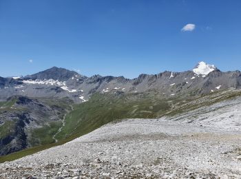
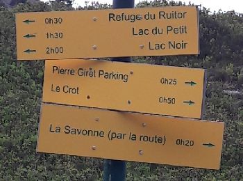
• magnifique randonnée d'abord une montée sur le plateau de la sassière et ensuite une montée d'un mandat l'herbe et un...
![Trail Walking La Plagne-Tarentaise - Les Fours - Photo](https://media.geolcdn.com/t/350/260/ext.jpg?maxdim=2&url=https%3A%2F%2Fservices.sitytrail.com%2FGeolivesWS%2FDownloadMedia.ashx%3FTrailID%3D962720%26Media%3Dfix__20180506164939.jpg)
![Walking Walking](https://static1.geolcdn.com/sitytour/trail-icons/101.png)
Km
Walking
![](/images/other/stat-length.png)
![](https://static1.geolcdn.com/siteimages/upload/files/1508320355ic_sort_den_pos_24dp.png)
![](https://static1.geolcdn.com/siteimages/upload/files/1508320355ic_sort_den_neg_24dp.png)
![](https://static1.geolcdn.com/siteimages/upload/files/16400158638029165_repeat_loop_refresh_sync_direction_icon.png)
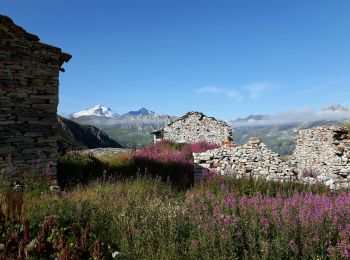
• au départ de Valezan, Balade facile vers Les Fours et le long du Canal des Chapelles. Panorama admirable et très ouve...
![Trail Cycle Villard-sur-Doron - Boucle Villars le Mont Crest Voland Les Saisies - Photo](https://media.geolcdn.com/t/350/260/ext.jpg?maxdim=2&url=https%3A%2F%2Fservices.sitytrail.com%2FGeolivesWS%2FDownloadMedia.ashx%3FTrailID%3D855162%26Media%3D20171031161248.jpg)
![Cycle Cycle](https://static1.geolcdn.com/sitytour/trail-icons/200.png)
Km
Cycle
![](/images/other/stat-length.png)
![](https://static1.geolcdn.com/siteimages/upload/files/1508320355ic_sort_den_pos_24dp.png)
![](https://static1.geolcdn.com/siteimages/upload/files/1508320355ic_sort_den_neg_24dp.png)
![](https://static1.geolcdn.com/siteimages/upload/files/16400158638029165_repeat_loop_refresh_sync_direction_icon.png)
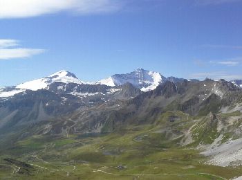
• Grande boucle assez difficile. Beaucoup de montées et aussi beaucoup de descentes…
![Trail Walking Bonneval-sur-Arc - Lac du Grand Mean - Photo](https://media.geolcdn.com/t/350/260/ext.jpg?maxdim=2&url=https%3A%2F%2Fservices.sitytrail.com%2FGeolivesWS%2FDownloadMedia.ashx%3FTrailID%3D806759%26Media%3Dfix__20170715120723.jpg)
![Walking Walking](https://static1.geolcdn.com/sitytour/trail-icons/101.png)
Km
Walking
![](/images/other/stat-length.png)
![](https://static1.geolcdn.com/siteimages/upload/files/1508320355ic_sort_den_pos_24dp.png)
![](https://static1.geolcdn.com/siteimages/upload/files/1508320355ic_sort_den_neg_24dp.png)
![](https://static1.geolcdn.com/siteimages/upload/files/16400158638029165_repeat_loop_refresh_sync_direction_icon.png)
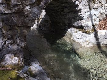
• Départ parking de l'écot Montée par la gorge de la Reculaz. Retour par le col des Evettes
![Trail Other activity Tignes - Refuge du Palet Col de la Tourne - Photo](https://media.geolcdn.com/t/350/260/ext.jpg?maxdim=2&url=https%3A%2F%2Fservices.sitytrail.com%2FGeolivesWS%2FDownloadMedia.ashx%3FTrailID%3D627243%26Media%3Deac5cf48-a447-4e5f-a31a-610b7e2f4089.jpg)
![Other activity Other activity](https://static1.geolcdn.com/sitytour/trail-icons/900.png)
Km
Other activity
![](/images/other/stat-length.png)
![](https://static1.geolcdn.com/siteimages/upload/files/1508320355ic_sort_den_pos_24dp.png)
![](https://static1.geolcdn.com/siteimages/upload/files/1508320355ic_sort_den_neg_24dp.png)
![](https://static1.geolcdn.com/siteimages/upload/files/16400158638029165_repeat_loop_refresh_sync_direction_icon.png)
20 trails displayed on 11722
FREE GPS app for hiking
Activities
Nearby regions
- Aiguebelette-le-Lac
- Aillon-le-Jeune
- Aillon-le-Vieux
- Aime-la-Plagne
- Aiton
- Aix-les-Bains
- Albertville
- Albiez-Montrond
- Albiez-le-Jeune
- Allondaz
- Apremont
- Arbin
- Argentine
- Arith
- Arvillard
- Attignat-Oncin
- Aussois
- Avressieux
- Avrieux
- Ayn
- Barberaz
- Barby
- Bassens
- Beaufort
- Bellecombe-en-Bauges
- Belmont-Tramonet
- Bessans
- Betton-Bettonet
- Billième
- Bonneval-sur-Arc
- Bonvillard
- Bonvillaret
- Bourdeau
- Bourg-Saint-Maurice
- Bourget-en-Huile
- Bourgneuf
- Bozel
- Brides-les-Bains
- Brison-Saint-Innocent
- Césarches
- Cevins
- Challes-les-Eaux
- Chambéry
- Chamousset
- Chamoux-sur-Gelon
- Champ-Laurent
- Champagneux
- Champagny-en-Vanoise
- Chanaz
- Châteauneuf
- Chignin
- Chindrieux
- Cléry
- Cognin
- Cohennoz
- Coise-Saint-Jean-Pied-Gauthier
- Conjux
- Corbel
- Courchevel
- Crest-Voland
- Cruet
- Curienne
- Détrier
- Domessin
- Doucy-en-Bauges
- Drumettaz-Clarafond
- Dullin
- École
- Entrelacs
- Entremont-le-Vieux
- Épierre
- Esserts-Blay
- Feissons-sur-Salins
- Flumet
- Fontcouverte-la-Toussuire
- Fourneaux
- Freney
- Fréterive
- Frontenex
- Gerbaix
- Gilly-sur-Isère
- Grand-Aigueblanche
- Grésy-sur-Aix
- Grésy-sur-Isère
- Grignon
- Hautecour
- Hauteluce
- Hauteville
- Jacob-Bellecombette
- Jarrier
- Jarsy
- Jongieux
- La Balme
- La Bâthie
- La Bauche
- La Biolle
- La Bridoire
- La Chambre
- La Chapelle
- La Chapelle-Blanche
- La Chapelle-Saint-Martin
- La Chapelle-du-Mont-du-Chat
- La Chavanne
- La Compôte
- La Croix-de-la-Rochette
- La Giettaz
- La Léchère
- La Motte-Servolex
- La Motte-en-Bauges
- La Plagne-Tarentaise
- La Ravoire
- La Table
- La Thuile
- La Tour-en-Maurienne
- La Trinité
- Laissaud
- Landry
- Le Bourget-du-Lac
- Le Châtelard
- Le Noyer
- Le Pont-de-Beauvoisin
- Le Pontet
- Le Verneil
- Lépin-le-Lac
- Les Allues
- Les Avanchers-Valmorel
- Les Belleville
- Les Chapelles
- Les Chavannes-en-Maurienne
- Les Déserts
- Les Échelles
- Les Mollettes
- Lescheraines
- Loisieux
- Lucey
- Marcieux
- Marthod
- Mercury
- Méry
- Meyrieux-Trouet
- Modane
- Montagnole
- Montagny
- Montailleur
- Montcel
- Montendry
- Montgilbert
- Monthion
- Montmélian
- Montricher-Albanne
- Montsapey
- Montvalezan
- Montvernier
- Motz
- Moûtiers
- Mouxy
- Myans
- Nances
- Notre-Dame-de-Bellecombe
- Notre-Dame-des-Millières
- Notre-Dame-du-Cruet
- Notre-Dame-du-Pré
- Novalaise
- Ontex
- Orelle
- Pallud
- Peisey-Nancroix
- Planaise
- Planay
- Plancherine
- Porte-de-Savoie
- Pralognan-la-Vanoise
- Presle
- Pugny-Chatenod
- Puygros
- Queige
- Rochefort
- Rognaix
- Rotherens
- Ruffieux
- Saint-Alban-Leysse
- Saint-Alban-d'Hurtières
- Saint-Alban-de-Montbel
- Saint-Alban-des-Villards
- Saint-André
- Saint-Avre
- Saint-Baldoph
- Saint-Béron
- Saint-Cassin
- Saint-Christophe
- Saint-Colomban-des-Villards
- Saint-Étienne-de-Cuines
- Saint-Franc
- Saint-François-Longchamp
- Saint-François-de-Sales
- Saint-Genix-les-Villages
- Saint-Georges-d'Hurtières
- Saint-Jean-d'Arves
- Saint-Jean-d'Arvey
- Saint-Jean-de-Chevelu
- Saint-Jean-de-Couz
- Saint-Jean-de-Maurienne
- Saint-Jean-de-la-Porte
- Saint-Jeoire-Prieuré
- Saint-Julien-Mont-Denis
- Saint-Léger
- Saint-Marcel
- Saint-Martin-d'Arc
- Saint-Martin-de-la-Porte
- Saint-Martin-sur-la-Chambre
- Saint-Michel-de-Maurienne
- Saint-Nicolas-la-Chapelle
- Saint-Offenge
- Saint-Ours
- Saint-Pancrace
- Saint-Paul
- Saint-Paul-sur-Isère
- Saint-Pierre-d'Albigny
- Saint-Pierre-d'Alvey
- Saint-Pierre-d'Entremont
- Saint-Pierre-de-Belleville
- Saint-Pierre-de-Curtille
- Saint-Pierre-de-Genebroz
- Saint-Pierre-de-Soucy
- Saint-Rémy-de-Maurienne
- Saint-Sorlin-d'Arves
- Saint-Sulpice
- Saint-Thibaud-de-Couz
- Saint-Vital
- Sainte-Foy-Tarentaise
- Sainte-Hélène-du-Lac
- Sainte-Hélène-sur-Isère
- Sainte-Marie-d'Alvey
- Sainte-Marie-de-Cuines
- Sainte-Reine
- Salins-Fontaine
- Séez
- Serrières-en-Chautagne
- Sonnaz
- Thénésol
- Thoiry
- Tignes
- Tournon
- Tours-en-Savoie
- Traize
- Tresserve
- Trévignin
- Ugine
- Val-Cenis
- Val-d'Arc
- Val-d'Isère
- Valgelon-La Rochette
- Valloire
- Valmeinier
- Venthon
- Verel-Pragondran
- Verel-de-Montbel
- Verrens-Arvey
- Verthemex
- Villard-Léger
- Villard-Sallet
- Villard-d'Héry
- Villard-sur-Doron
- Villarembert
- Villargondran
- Villarodin-Bourget
- Villaroger
- Villaroux
- Vimines
- Vions
- Viviers-du-Lac
- Voglans
- Yenne