


drosset

gerard70
User
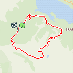

Length
21 km

Max alt
2901 m

Uphill gradient
1045 m
Km-Effort
35 km

Min alt
2011 m

Downhill gradient
1046 m
Boucle
Yes
Creation date :
2019-01-15 13:07:30.051
Updated on :
2019-01-15 13:07:30.051
9h59
Difficulty : Difficult

FREE GPS app for hiking
 SityTrail
IGN / Geographical institutes
SityTrail Plus
The world is yours!
About
Trail Walking of 21 km to be discovered at Auvergne-Rhône-Alpes, Savoy, Val-Cenis. This trail is proposed by gerard70.
Positioning
Country:
France
Region :
Auvergne-Rhône-Alpes
Department/Province :
Savoy
Municipality :
Val-Cenis
Location:
Bramans
Start:(Dec)
Start:(UTM)
333951 ; 5009327 (32T) N.
Comments