


PRALOGNAN-LA-VANOISE (73).

AndreLACOMBE
User
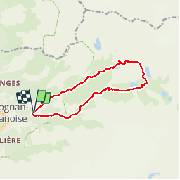

Length
14 km

Max alt
2517 m

Uphill gradient
872 m
Km-Effort
26 km

Min alt
1646 m

Downhill gradient
868 m
Boucle
Yes
Creation date :
2019-01-15 13:10:04.608
Updated on :
2019-01-15 13:10:04.608
8h07
Difficulty : Medium

FREE GPS app for hiking
 SityTrail
IGN / Geographical institutes
SityTrail Plus
The world is yours!
About
Trail Walking of 14 km to be discovered at Auvergne-Rhône-Alpes, Savoy, Pralognan-la-Vanoise. This trail is proposed by AndreLACOMBE.
Description
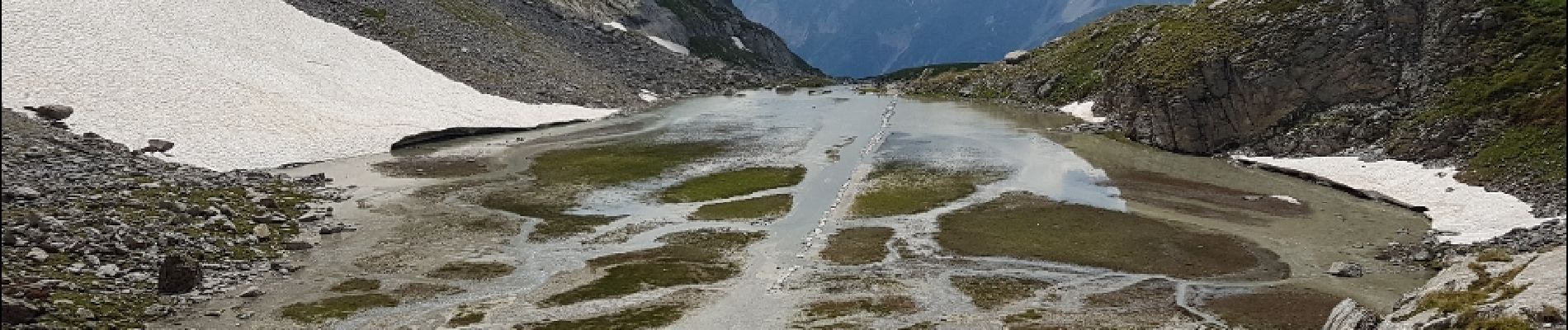
Au départ des Fontanettes, tour de l'Aiguille de la Vanoise.
Photos
. - Photo 1")
. - Photo 2")
. - Photo 3")
. - Photo 4")
Positioning
Country:
France
Region :
Auvergne-Rhône-Alpes
Department/Province :
Savoy
Municipality :
Pralognan-la-Vanoise
Location:
Unknown
Start:(Dec)
Start:(UTM)
322730 ; 5027866 (32T) N.
Comments