Trail Walking Saint-Félix-Lauragais - Bouclé à Cadenac ! - Photo
 tracegps
tracegps

User

© OpenStreetMap contributors
Length
Length
14.8 km
Max alt
Max alt
307 m
Uphill gradient
Uphill gradient
207 m
Km-Effort
Km-Effort  
17.5 km
Min alt
Min alt
202 m
Downhill gradient
Downhill gradient
206 m
Boucle
Boucle
Yes
Creation date :
2014-12-10 00:00:00.0
Updated on :
2014-12-10 00:00:00.0

(0 Reviews)

Walking
Walking
3h00
Difficulty : Difficult

Scan this QR Code to open this trail in the SityTrail application

FREE GPS app for hiking

Logo SityTrail SityTrail

IGN / Geographical institutes

Download SityTrail from the App Store Download SityTrail from Google Play

Logo SityTrail SityTrail World

The world is yours!

Download SityTrail from the App Store Download SityTrail from Google Play Download SityTrail on Huawei AppGallery

About

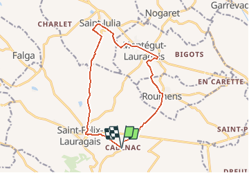
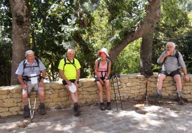
Trail Walking of 14.8 km to be discovered at Occitania, Haute-Garonne, Saint-Félix-Lauragais. This trail is proposed by tracegps.

Description

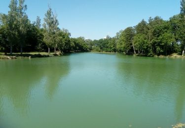
Belle étendue d'eau dans Roumens, et magnifique village de St Julia avec un beau point de vue sur St Félix. Un ancien lavoir en bas de St Julia sur le chemin du retour, un bonheur dans le Lauragais !

Elevation profile

Positioning

Country:
France
Region :
Occitania
Department/Province :
Haute-Garonne
Municipality :
Saint-Félix-Lauragais
Location:
Unknown
Start:(UTM)
411700 ; 4810748 (31T) N.

Trails nearby

Trail Walking Les Cassés - Les Cassés - Avignonet - Photo
Walking
RR31

Walking

Medium
(1)
Les Cassés, Occitania, Aude, France
27 km | 30 km-effort
7h 48min
No
Trail On foot Les Cassés - boucle des cuestas - Photo
On foot
PRO

On foot

Medium
Les Cassés, Occitania, Aude, France
18 km | 22 km-effort
5h 1min
Yes
Trail Walking Saint-Félix-Lauragais - rando fermes - Photo
Walking
Philplaisir

Walking

Very easy
Saint-Félix-Lauragais, Occitania, Haute-Garonne, France
11.6 km | 12.9 km-effort
3h 42min
No
Trail Walking Les Cassés - c2pa_les-cassés_st-paulet_tacagnou - Photo
Walking
arnoultjf

Walking

Medium
Les Cassés, Occitania, Aude, France
9.3 km | 11.3 km-effort
2h 34min
Yes
Trail Walking Saint-Félix-Lauragais - c2pa-lenclas-15/05 - Photo
Walking
arnoultjf

Walking

Medium
Saint-Félix-Lauragais, Occitania, Haute-Garonne, France
9.2 km | 9.8 km-effort
2h 18min
Yes
Trail Walking La Pomarède - 2018-09-02 La Pomaréde - Tréville - Photo
Walking
jpp2caunes

Walking

Difficult
La Pomarède, Occitania, Aude, France
13.3 km | 16.7 km-effort
3h 35min
Yes
Trail Running Falga - Falga - Auriac sur Vendinelle - Photo
Running
tracegps

Running

Difficult
Falga, Occitania, Haute-Garonne, France
15 km | 17.4 km-effort
1h 30min
Yes
Trail Walking Saint-Félix-Lauragais - Randonnée pédestre à St-Félix-Lauragais - Photo
Walking
cappelle

Walking

Easy
Saint-Félix-Lauragais, Occitania, Haute-Garonne, France
8.8 km | 11.2 km-effort
2h 33min
Yes
Trail Electric bike Saint-Félix-Lauragais - De Lenclas à Santa Fé - Photo
Electric bike
jpp2caunes

Electric bike

Very easy
Saint-Félix-Lauragais, Occitania, Haute-Garonne, France
15.9 km | 18.7 km-effort
1h 45min
No


Close
My subscriptions