


CHAMPAGNY-EN-VANOISE (73)

AndreLACOMBE
User
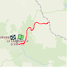

Length
14.7 km

Max alt
2617 m

Uphill gradient
1068 m
Km-Effort
29 km

Min alt
1559 m

Downhill gradient
1068 m
Boucle
Yes
Creation date :
2019-01-15 13:16:10.144
Updated on :
2019-01-15 13:16:10.144
8h38
Difficulty : Difficult

FREE GPS app for hiking
 SityTrail
IGN / Geographical institutes
SityTrail Plus
The world is yours!
About
Trail Walking of 14.7 km to be discovered at Auvergne-Rhône-Alpes, Savoy, Champagny-en-Vanoise. This trail is proposed by AndreLACOMBE.
Description
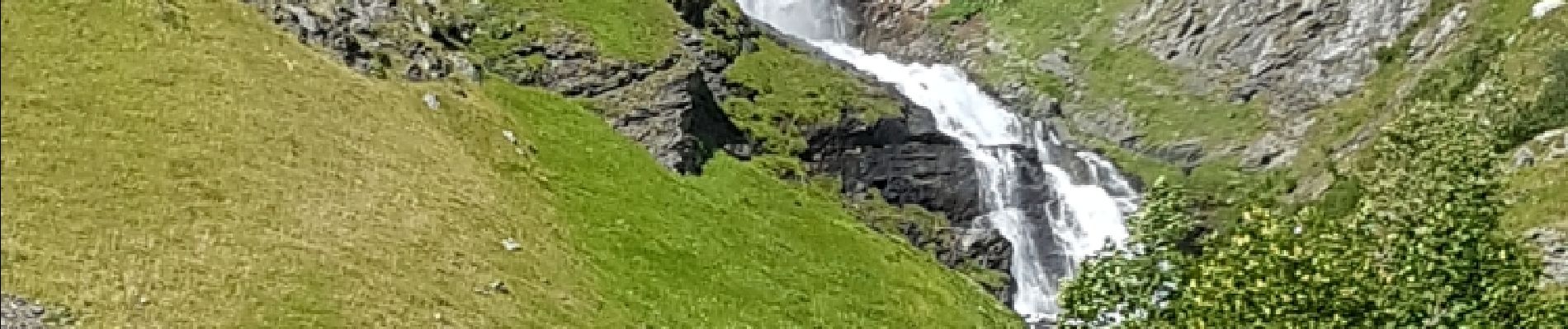
Départ du Laisonnay d'En bas pour refuge de Plaisance et col du Plan Séry (2609 m). Retour par le même itinéraire.
Photos
 - Photo 1")
 - Photo 2")
 - Photo 3")
 - Photo 4")
 - Photo 5")
 - Photo 6")
 - Photo 7")
 - Photo 8")
 - Photo 9")
Positioning
Country:
France
Region :
Auvergne-Rhône-Alpes
Department/Province :
Savoy
Municipality :
Champagny-en-Vanoise
Location:
Unknown
Start:(Dec)
Start:(UTM)
326173 ; 5035321 (32T) N.
Comments