


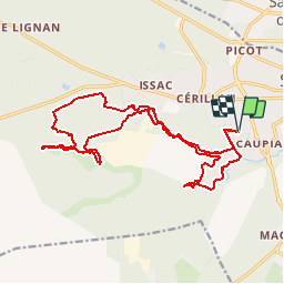

10.6 km | 11.9 km-effort


User


FREE GPS app for hiking
 SityTrail
IGN / Geographical institutes
SityTrail World
The world is yours!
Trail Mountain bike of 20 km to be discovered at New Aquitaine, Gironde, Saint-Médard-en-Jalles. This trail is proposed by tracegps.
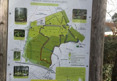
Départ au bout de l'allée Jules Védrines au parking de la plaine des sports des Biges. Circuit très ludique au milieu des bois mais assez technique. Le port du casque est vraiment indispensable sur ce circuit car les troncs d'arbres ne sont jamais très loin. Il s'agit sur une grande partie d'un single track longeant la jalle. Une bonne condition physique est nécessaire car il y a pas mal de petites montée et descentes, très court mais fatiguant. A plusieurs endroits, les chemins aller et retour sont très proches et il est possible de faire demi-tour. Au niveau du sol, pas mal de boue en hiver et pas mal de sable en été. Certaines portions du circuit ne sont pas praticables s'il y a vraiment trop d'eau.

Walking
Walking
Walking
Walking
Walking
Walking
Walking
Walking
Walking
le top !
Une super aprèm, trace géniale avec 90% de single track parfois légèrement techniques, un régal malgré la pluie sur le tiers du parcours et la gadou sur le retour. A refaire ! Par contre niveau difficulté je dirais au pire mais vraiment au pire moyen, mais pas difficile.