


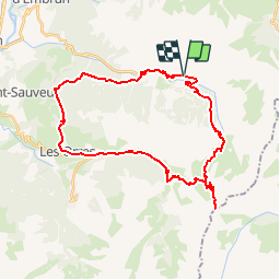

7.2 km | 11 km-effort

User


FREE GPS app for hiking
 SityTrail
IGN / Geographical institutes
SityTrail World
The world is yours!
Trail Mountain bike of 36 km to be discovered at Provence-Alpes-Côte d'Azur, Hautes-Alpes, Crévoux. This trail is proposed by tracegps.
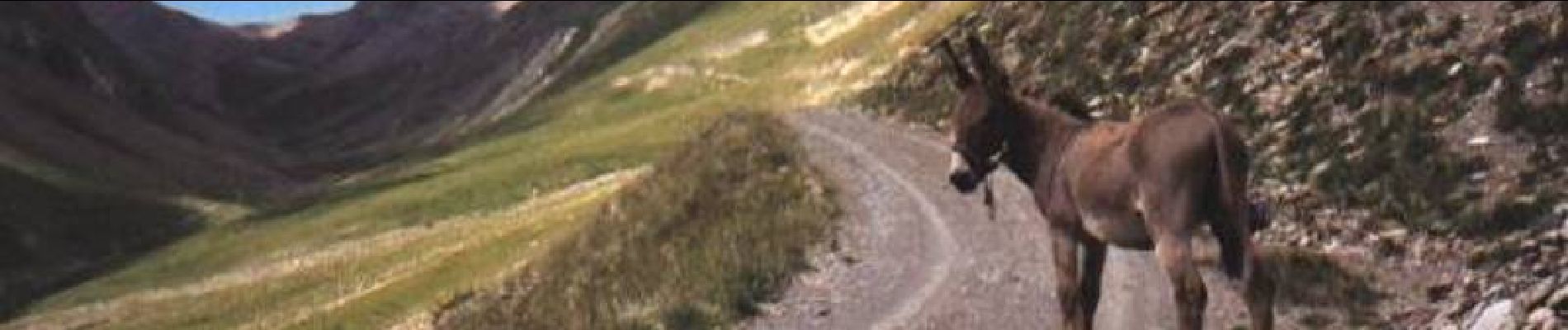
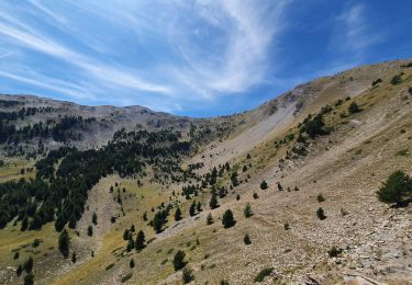
S'il est un col de légende c'est bien le Parpaillon ! Situé à la limite des Alpes de Haute Provence et des Hautes Alpes, il culmine à 2637m sur une crête séparant la vallée de la Durance et celle de l'Ubaye. Ce col a été ouvert par les troupes du Génie Militaire comme beaucoup d'autres passages jalonnant la Grande Traversée des Alpes entre Thonon et Nice. La "chance" du Parpaillon, c'est de s'être trouvé en concurrence avec le col de Vars qui permettait de relier les mêmes vallées mais à une altitude inférieure de 500m, lorsque le goudron a fait son apparition, c'est tout naturellement le col de Vars qui en a été gratifié ! Le col du Parpaillon est donc un des derniers témoins de ce que pouvait être un grand col alpin avant l'ère de l'automobile et du goudron. ( Source )


Walking

Other activity

Walking

Walking

Walking
Walking

Walking
Touring skiing
Walking