


st rhemy la thuile

les randos d'Olivier
partout a pied et en moto

Length
91 km

Max alt
1964 m

Uphill gradient
2906 m
Km-Effort
130 km

Min alt
757 m

Downhill gradient
3091 m
Boucle
No
Creation date :
2019-01-14 09:42:19.107
Updated on :
2019-01-14 09:42:19.458
--
Difficulty : Unknown

FREE GPS app for hiking
 SityTrail
IGN / Geographical institutes
SityTrail Plus
The world is yours!
About
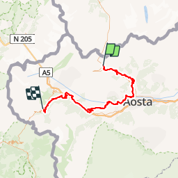
Trail Walking of 91 km to be discovered at Aosta Valley, Unknown, Saint-Rhémy-en-Bosses. This trail is proposed by les randos d'Olivier.
Positioning
Country:
Italy
Region :
Aosta Valley
Department/Province :
Unknown
Municipality :
Saint-Rhémy-en-Bosses
Location:
Unknown
Start:(Dec)
Start:(UTM)
358959 ; 5077386 (32T) N.
Comments