


aoste monuments

stef789
User GUIDE
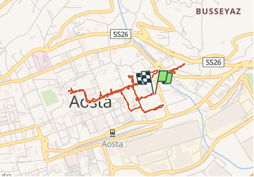

Length
5.8 km

Max alt
593 m

Uphill gradient
32 m
Km-Effort
6.2 km

Min alt
578 m

Downhill gradient
31 m
Boucle
Yes
Creation date :
2019-01-15 13:31:04.853
Updated on :
2019-01-15 13:31:04.853
2h48
Difficulty : Unknown

FREE GPS app for hiking
 SityTrail
IGN / Geographical institutes
SityTrail Plus
The world is yours!
About
Trail Other activity of 5.8 km to be discovered at Aosta Valley, Unknown, Aosta. This trail is proposed by stef789.
Positioning
Country:
Italy
Region :
Aosta Valley
Department/Province :
Unknown
Municipality :
Aosta
Location:
Unknown
Start:(Dec)
Start:(UTM)
369896 ; 5066277 (32T) N.
Comments