Trail Mountain bike Toulaud -  Valence - Arcens - Photo
 tracegps
tracegps

User

© OpenStreetMap contributors
Length
Length
63 km
Max alt
Max alt
998 m
Uphill gradient
Uphill gradient
2124 m
Km-Effort
Km-Effort  
90 km
Min alt
Min alt
273 m
Downhill gradient
Downhill gradient
1777 m
Boucle
Boucle
No
Creation date :
2014-12-10 00:00:00.0
Updated on :
2014-12-10 00:00:00.0

(0 Reviews)

Mountain bike
Mountain bike
5h00
Difficulty : Very difficult

Scan this QR Code to open this trail in the SityTrail application

FREE GPS app for hiking

Logo SityTrail SityTrail

IGN / Geographical institutes

Download SityTrail from the App Store Download SityTrail from Google Play

Logo SityTrail SityTrail World

The world is yours!

Download SityTrail from the App Store Download SityTrail from Google Play Download SityTrail on Huawei AppGallery

About

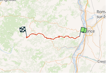
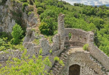
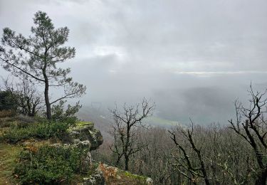
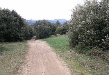
Trail Mountain bike of 63 km to be discovered at Auvergne-Rhône-Alpes, Ardèche, Toulaud. This trail is proposed by tracegps.

Description

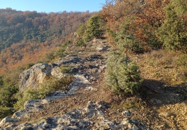
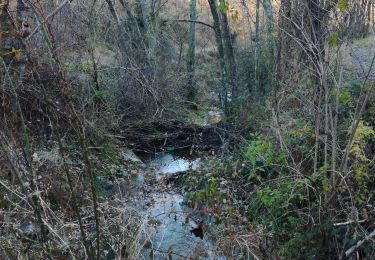
24 Mai 2005 1ère étape du Valence-Lalo 2005 La nuit a été courte pour certains. La descente de Chalencon a été vertigineuse. La bonne surprise est la superbe piste du GR420 au dessus du cheylard. Elle se mérite avec une côte et un portage très difficile. On retrouvera Nadine partie du Col de la Chavade pour la descente sur Arcens. La suite est ICI

Elevation profile

Photos

Positioning

Country:
France
Region :
Auvergne-Rhône-Alpes
Department/Province :
Ardèche
Municipality :
Toulaud
Location:
Unknown
Start:(UTM)
643464 ; 4972984 (31T) N.

Trails nearby

Trail Walking Toulaud - Château de Crussol par Meyret - Photo
Walking
crocau

Walking

Medium
(1)
Toulaud, Auvergne-Rhône-Alpes, Ardèche, France
7.6 km | 11.1 km-effort
3h 14min
Yes
Trail Walking  - boucle rotisson col de mure - Photo
Walking
tompaulet

Walking

Medium
(1)
, Auvergne-Rhône-Alpes, Ardèche, France
16.4 km | 23 km-effort
4h 0min
Yes
Trail Walking Toulaud - 07 toulaud  - Photo
Walking
himba26100

Walking

Very easy
Toulaud, Auvergne-Rhône-Alpes, Ardèche, France
7.1 km | 10.9 km-effort
2h 24min
Yes
Trail Walking Saint-Georges-les-Bains - Saint Georges les Bains - Photo
Walking
Jean Claude Marchand

Walking

Very difficult
Saint-Georges-les-Bains, Auvergne-Rhône-Alpes, Ardèche, France
16.4 km | 23 km-effort
5h 19min
Yes
Trail Walking Saint-Georges-les-Bains -  col de Rotison - Photo
Walking
jphugon

Walking

Difficult
Saint-Georges-les-Bains, Auvergne-Rhône-Alpes, Ardèche, France
9.4 km | 14.4 km-effort
6h 7min
Yes
Trail Walking Toulaud - Gorges de l'Embroye  - Photo
Walking
cousam

Walking

Difficult
Toulaud, Auvergne-Rhône-Alpes, Ardèche, France
7.3 km | 10.5 km-effort
2h 45min
Yes
Trail Walking  - Gilhac et Bruzac - Photo
Walking
AIGUIER

Walking

Medium
, Auvergne-Rhône-Alpes, Ardèche, France
17.9 km | 25 km-effort
8h 4min
Yes
Trail Mountain bike Guilherand-Granges - guilherand-st peray-tracol-st peray-Cornas-guilherand - Photo
Mountain bike
aps07

Mountain bike

Medium
Guilherand-Granges, Auvergne-Rhône-Alpes, Ardèche, France
30 km | 36 km-effort
3h 1min
Yes
Trail Walking Toulaud - toulaud  - Photo
Walking
cousam

Walking

Medium
Toulaud, Auvergne-Rhône-Alpes, Ardèche, France
5.7 km | 9 km-effort
2h 4min
Yes


Close
My subscriptions