Trail Mountain bike Montpezat-sous-Bauzon - Montpezat - La Bastide Puylaurent - Photo

Montpezat - La Bastide Puylaurent

 tracegps
tracegps

User

© OpenStreetMap contributors
Length
Length
69 km
Max alt
Max alt
1438 m
Uphill gradient
Uphill gradient
2608 m
Km-Effort
Km-Effort  
102 km
Min alt
Min alt
524 m
Downhill gradient
Downhill gradient
2089 m
Boucle
Boucle
No
Creation date :
2014-12-10 00:00:00.0
Updated on :
2014-12-10 00:00:00.0

(0 Reviews)

Mountain bike
Mountain bike
4h30
Difficulty : Very difficult

Scan this QR Code to open this trail in the SityTrail application

FREE GPS app for hiking

Logo SityTrail SityTrail

IGN / Geographical institutes

Download SityTrail from the App Store Download SityTrail from Google Play

Logo SityTrail SityTrail World

The world is yours!

Download SityTrail from the App Store Download SityTrail from Google Play Download SityTrail on Huawei AppGallery

About

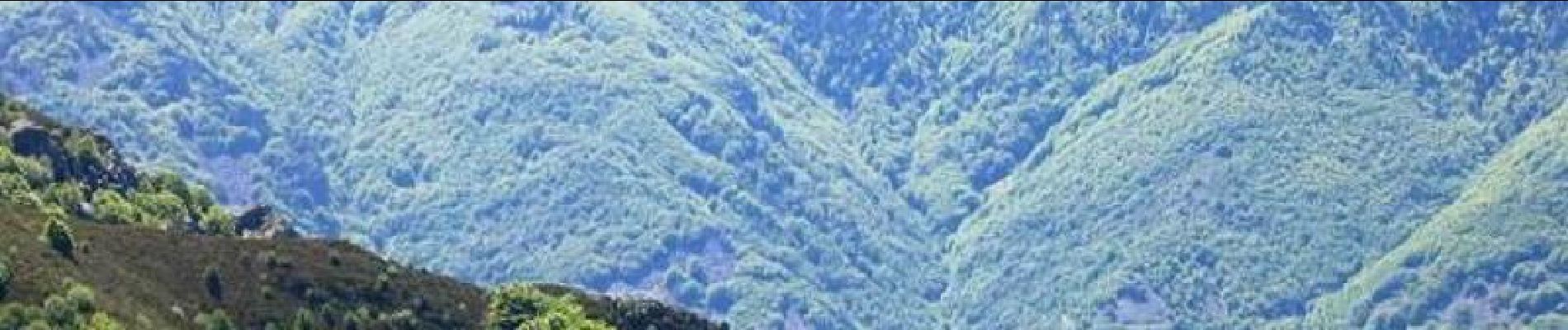
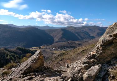
Trail Mountain bike of 69 km to be discovered at Auvergne-Rhône-Alpes, Ardèche, Montpezat-sous-Bauzon. This trail is proposed by tracegps.

Description

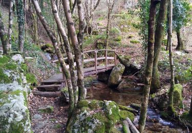
26 Mai 2005 3ème étape de Valence Lalo 2005 Etape très difficile qui nous fait changer de département. Un portage très beau et très long nous amènera au col de la Chavade lieu du picnic. A partir du Bez, une option permet d'aller voir la vue au Col de Meyrand. Entre le Bez et NotreDame des Neiges, le chemin et difficile mais vraiment génial : tout en crête. La suite est ICI

Elevation profile

Photos

Positioning

Country:
France
Region :
Auvergne-Rhône-Alpes
Department/Province :
Ardèche
Municipality :
Montpezat-sous-Bauzon
Location:
Unknown
Start:(UTM)
597050 ; 4950395 (31T) N.

Trails nearby

Trail Walking Saint-Pierre-de-Colombier - SityTrail - 2775482 - st-pierre-burzet - Photo
Walking
coureursdecretes

Walking

Very difficult
(1)
Saint-Pierre-de-Colombier, Auvergne-Rhône-Alpes, Ardèche, France
11.5 km | 17.1 km-effort
4h 45min
Yes
Trail Walking Meyras - neyrac les bains - Photo
Walking
raab

Walking

Easy
(1)
Meyras, Auvergne-Rhône-Alpes, Ardèche, France
4.4 km | 6.8 km-effort
1h 36min
Yes
Trail Walking Chirols - Ste Marguerite - Photo
Walking
Michel07

Walking

Medium
(2)
Chirols, Auvergne-Rhône-Alpes, Ardèche, France
12.7 km | 22 km-effort
3h 57min
Yes
Trail Walking Barnas - 231220 Barnas  - Photo
Walking
Rudy07

Walking

Medium
Barnas, Auvergne-Rhône-Alpes, Ardèche, France
6.7 km | 9.9 km-effort
2h 15min
Yes
Trail Walking Thueyts - 231217 Thueyts-Brige - Photo
Walking
Rudy07

Walking

Easy
(1)
Thueyts, Auvergne-Rhône-Alpes, Ardèche, France
5.7 km | 9.6 km-effort
2h 11min
Yes
Trail Walking Meyras - Balade Neyrac Bas - Neyrac haut - Souihol - Photo
Walking
coureursdecretes

Walking

Medium
(1)
Meyras, Auvergne-Rhône-Alpes, Ardèche, France
5.9 km | 9 km-effort
2h 2min
Yes
Trail Walking Burzet - Burzet -  Peyreyres a/r - Photo
Walking
coureursdecretes

Walking

Very difficult
Burzet, Auvergne-Rhône-Alpes, Ardèche, France
12.8 km | 19.4 km-effort
4h 23min
Yes
Trail Walking Thueyts - Thueyts-Autureyre-4 chemins-La Teyre - Photo
Walking
coureursdecretes

Walking

Medium
Thueyts, Auvergne-Rhône-Alpes, Ardèche, France
13.2 km | 20 km-effort
4h 28min
Yes
Trail Walking Montpezat-sous-Bauzon - 07-Montpezat-sous-Bauzon - Plantades-Clastre-St-Roch-Clastre - Photo
Walking
Maryma

Walking

Medium
Montpezat-sous-Bauzon, Auvergne-Rhône-Alpes, Ardèche, France
7.3 km | 11.6 km-effort
2h 0min
Yes


Close
My subscriptions