Trail Mountain bike Simiane-Collongue - Pilon du Roi - Photo
 tracegps
tracegps

User

© OpenStreetMap contributors
Length
Length
18.2 km
Max alt
Max alt
648 m
Uphill gradient
Uphill gradient
537 m
Km-Effort
Km-Effort  
25 km
Min alt
Min alt
207 m
Downhill gradient
Downhill gradient
550 m
Boucle
Boucle
Yes
Creation date :
2014-12-10 00:00:00.0
Updated on :
2014-12-10 00:00:00.0

(0 Reviews)

Mountain bike
Mountain bike
2h00
Difficulty : Difficult

Scan this QR Code to open this trail in the SityTrail application

FREE GPS app for hiking

Logo SityTrail SityTrail

IGN / Geographical institutes

Download SityTrail from the App Store Download SityTrail from Google Play

Logo SityTrail SityTrail World

The world is yours!

Download SityTrail from the App Store Download SityTrail from Google Play Download SityTrail on Huawei AppGallery

About

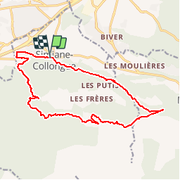
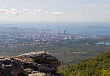
Trail Mountain bike of 18.2 km to be discovered at Provence-Alpes-Côte d'Azur, Bouches-du-Rhône, Simiane-Collongue. This trail is proposed by tracegps.

Description

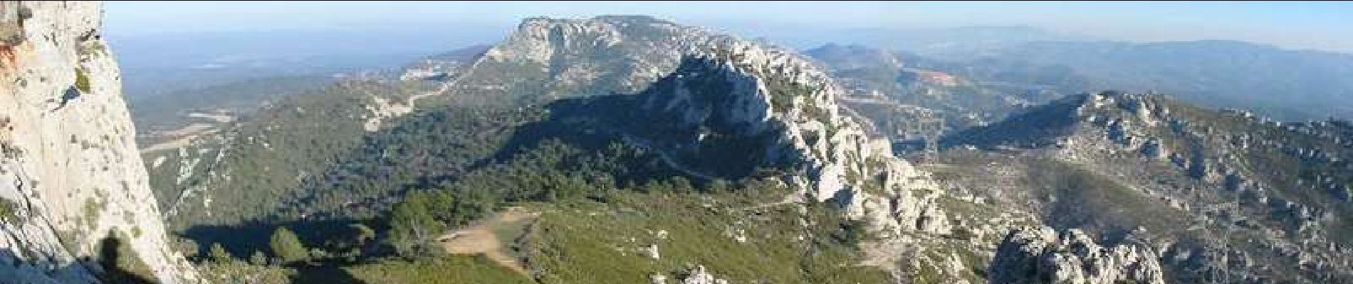
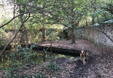
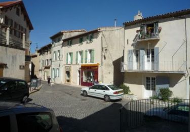
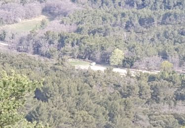
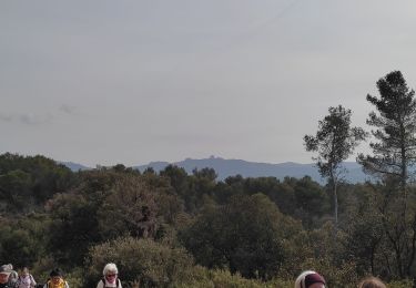
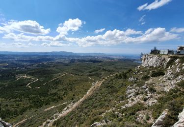
Le circuit peut se faire dans les 2 sens avec des difficultés différentes. Dans le sens initial, il faut prévoir une montée continue de plus près d'1h15 avec une vue EXCEPTIONNELLE. Arrivé au Pilon du Roi (Rocher), on a une vue imprenable sur la Sainte Victoire (Aix en Provence dans le fond) et de l'autre côté, une vue sur Marseille et l'etang de Berre! Après la montée, la descente (arbres, verdure ...). On ne croise pas beaucoup de monde dans la montée mais on croise des marcheurs dans la descente et il faudra faire attention aux enfants. La montée est 'cassante' sur route rocheuse (j'ai déjà déchiré un tubeless!). J'ai fait le montée avec un tout suspendu (Rockrider 9xc et Cannondale Jekyl700), mais ce n'est pas indispensable! Il n'y a pas de portage. A l'arrivée, une boulangerie à quelques mètres pour se ravitailler ! On gare sa voiture près du point de départ à Simiane. Bon VTT !

Elevation profile

Photos

Positioning

Country:
France
Region :
Provence-Alpes-Côte d'Azur
Department/Province :
Bouches-du-Rhône
Municipality :
Simiane-Collongue
Location:
Unknown
Start:(UTM)
697092 ; 4811340 (31T) N.

Trails nearby

Trail Walking Simiane-Collongue - chemin de gui - Photo
Walking
rvdebouc

Walking

Easy
(1)
Simiane-Collongue, Provence-Alpes-Côte d'Azur, Bouches-du-Rhône, France
5.9 km | 8.1 km-effort
1h 45min
Yes
Trail Running Bouc-Bel-Air - Balade à Bouc Bel Air - Photo
Running
tracegps

Running

Medium
(1)
Bouc-Bel-Air, Provence-Alpes-Côte d'Azur, Bouches-du-Rhône, France
6.6 km | 8.7 km-effort
34min
Yes
Trail Mountain bike Bouc-Bel-Air - MOUNINE - Photo
Mountain bike
lemusicoss

Mountain bike

Difficult
(2)
Bouc-Bel-Air, Provence-Alpes-Côte d'Azur, Bouches-du-Rhône, France
20 km | 28 km-effort
3h 0min
Yes
Trail Electric bike Simiane-Collongue - LES MARRES PILON DU ROI - Photo
Electric bike
GUIDE
harydh

Electric bike

Easy
Simiane-Collongue, Provence-Alpes-Côte d'Azur, Bouches-du-Rhône, France
26 km | 36 km-effort
2h 18min
Yes
Trail Walking Bouc-Bel-Air - Bouc bel air - Photo
Walking
sereton

Walking

Medium
Bouc-Bel-Air, Provence-Alpes-Côte d'Azur, Bouches-du-Rhône, France
8.9 km | 11.7 km-effort
2h 44min
Yes
Trail Walking Mimet - Massif de l'Etoile: Col Ste Anne, Pilon, Col des Ouides - Photo
Walking
phidge

Walking

Very difficult
(1)
Mimet, Provence-Alpes-Côte d'Azur, Bouches-du-Rhône, France
12.3 km | 19.4 km-effort
4h 49min
Yes
Trail Walking Mimet - le Baou traouca et la grotte des fées - Photo
Walking
GUIDE
amiral13

Walking

Medium
Mimet, Provence-Alpes-Côte d'Azur, Bouches-du-Rhône, France
11.2 km | 17.7 km-effort
5h 11min
Yes
Trail Walking Mimet - la chaîne de l'étoile au départ du col Sainte-Anne - Photo
Walking
GUIDE
amiral13

Walking

Difficult
Mimet, Provence-Alpes-Côte d'Azur, Bouches-du-Rhône, France
16.2 km | 25 km-effort
5h 58min
Yes
Trail Walking Simiane-Collongue - SityTrail - Etoile-Petit Sanguin - Photo
Walking
MicDul

Walking

Very difficult
Simiane-Collongue, Provence-Alpes-Côte d'Azur, Bouches-du-Rhône, France
14.8 km | 21 km-effort
4h 23min
Yes


Close
My subscriptions