Trail Mountain bike Bouc-Bel-Air - MOUNINE - Photo
© OpenStreetMap contributors
Length
Length
20 km
Max alt
Max alt
325 m
Uphill gradient
Uphill gradient
625 m
Km-Effort
Km-Effort  
28 km
Min alt
Min alt
177 m
Downhill gradient
Downhill gradient
626 m
Boucle
Boucle
Yes
Creation date :
2014-12-10 00:00:00.0
Updated on :
2014-12-10 00:00:00.0

(2 Reviews)

Mountain bike
Mountain bike
3h00
Difficulty : Difficult

Scan this QR Code to open this trail in the SityTrail application

FREE GPS app for hiking

Logo SityTrail SityTrail

IGN / Geographical institutes

Download SityTrail from the App Store Download SityTrail from Google Play

Logo SityTrail SityTrail World

The world is yours!

Download SityTrail from the App Store Download SityTrail from Google Play Download SityTrail on Huawei AppGallery

About

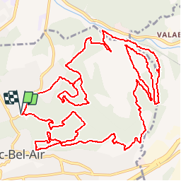
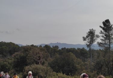
Trail Mountain bike of 20 km to be discovered at Provence-Alpes-Côte d'Azur, Bouches-du-Rhône, Bouc-Bel-Air. This trail is proposed by lemusicoss.

Description

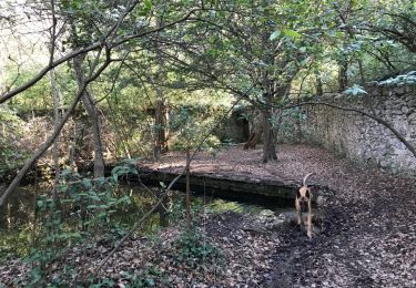
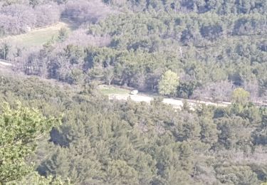
Un parcours de 20 km de long et 643m D /- dans les bois de Bouc Bel Air. Départ du parking de centre aéré de la Mounine.
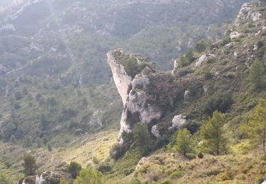
Un parcours comprenant plusieurs montées et décentes de courte distance dans des bois.
Il est possible d'améliorer surtout la montée au nord-est du bassin de rétention, car trop de copeaux de bois avant d'arriver au DFCI et la dernière montée.

Elevation profile

Positioning

Country:
France
Region :
Provence-Alpes-Côte d'Azur
Department/Province :
Bouches-du-Rhône
Municipality :
Bouc-Bel-Air
Location:
Unknown
Start:(UTM)
695413 ; 4814549 (31T) N.

Comments

Please log in to post a review or rate the element


Trails nearby

Trail Walking Simiane-Collongue - chemin de gui - Photo
Walking
rvdebouc

Walking

Easy
(1)
Simiane-Collongue, Provence-Alpes-Côte d'Azur, Bouches-du-Rhône, France
5.9 km | 8.1 km-effort
1h 45min
Yes
Trail Running Bouc-Bel-Air - Balade à Bouc Bel Air - Photo
Running
tracegps

Running

Medium
(1)
Bouc-Bel-Air, Provence-Alpes-Côte d'Azur, Bouches-du-Rhône, France
6.6 km | 8.7 km-effort
34min
Yes
Trail Electric bike Simiane-Collongue - LES MARRES PILON DU ROI - Photo
Electric bike
GUIDE
harydh

Electric bike

Easy
Simiane-Collongue, Provence-Alpes-Côte d'Azur, Bouches-du-Rhône, France
26 km | 36 km-effort
2h 18min
Yes
Trail Walking Bouc-Bel-Air - Bouc bel air - Photo
Walking
sereton

Walking

Medium
Bouc-Bel-Air, Provence-Alpes-Côte d'Azur, Bouches-du-Rhône, France
8.9 km | 11.7 km-effort
2h 44min
Yes
Trail Walking Simiane-Collongue - SityTrail - Etoile-Petit Sanguin - Photo
Walking
MicDul

Walking

Very difficult
Simiane-Collongue, Provence-Alpes-Côte d'Azur, Bouches-du-Rhône, France
14.8 km | 21 km-effort
4h 23min
Yes
Trail Walking Simiane-Collongue - De Simiane-Collongue au Pilon du Roi - Photo
Walking
LtZIP

Walking

Medium
Simiane-Collongue, Provence-Alpes-Côte d'Azur, Bouches-du-Rhône, France
13.6 km | 23 km-effort
4h 44min
No
Trail Walking Bouc-Bel-Air - bouc cabries par les crêtes  - Photo
Walking
rvdebouc

Walking

Very easy
(1)
Bouc-Bel-Air, Provence-Alpes-Côte d'Azur, Bouches-du-Rhône, France
3.5 km | 4.7 km-effort
47min
Yes
Trail Walking Simiane-Collongue - simiane - Photo
Walking
ARPF

Walking

Medium
(1)
Simiane-Collongue, Provence-Alpes-Côte d'Azur, Bouches-du-Rhône, France
16.1 km | 23 km-effort
6h 45min
Yes
Trail Mountain bike Simiane-Collongue - Pilon du Roi - Photo
Mountain bike
tracegps

Mountain bike

Difficult
Simiane-Collongue, Provence-Alpes-Côte d'Azur, Bouches-du-Rhône, France
18.2 km | 25 km-effort
2h 0min
Yes


Close
My subscriptions