Trail Mountain bike Préchac - Vallée du Ciron - Photo
 tracegps
tracegps

User

© OpenStreetMap contributors
Length
Length
34 km
Max alt
Max alt
83 m
Uphill gradient
Uphill gradient
292 m
Km-Effort
Km-Effort  
38 km
Min alt
Min alt
25 m
Downhill gradient
Downhill gradient
293 m
Boucle
Boucle
Yes
Creation date :
2014-12-10 00:00:00.0
Updated on :
2014-12-10 00:00:00.0

(0 Reviews)

Mountain bike
Mountain bike
3h00
Difficulty : Difficult

Scan this QR Code to open this trail in the SityTrail application

FREE GPS app for hiking

Logo SityTrail SityTrail

IGN / Geographical institutes

Download SityTrail from the App Store Download SityTrail from Google Play

Logo SityTrail SityTrail World

The world is yours!

Download SityTrail from the App Store Download SityTrail from Google Play Download SityTrail on Huawei AppGallery

About

Trail Mountain bike of 34 km to be discovered at New Aquitaine, Gironde, Préchac. This trail is proposed by tracegps.

Description

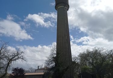
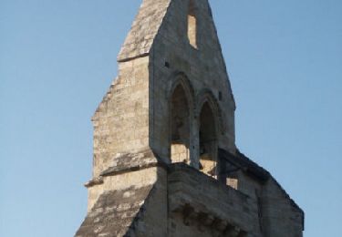
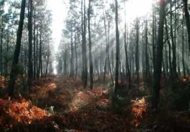
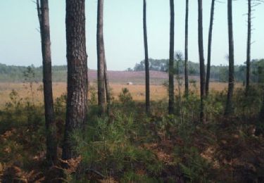
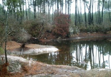
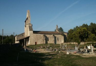
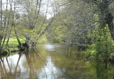
Départ Garer son véhicule a proximité de l’Eglise d’Insos et emprunter la route pour rejoindre le circuit. Itinéraire Le Ciron est un affluent de la Garonne qui traverse le vignoble du Sauternais. Entre Bernos et Villandraut, il forme de surprenantes gorges recouverte d’une « forêt galerie ». Le circuit situé dans les landes girondines (Bazadais, Sud-Gironde) part de la petite église d’Insos perdue au cœur de la pignada, emprunte un peu de route goudronnée avant de s’enfoncer dans les bois. Au moulin de Caussarieu, vous pourrez prendre un sentier qui mène au Ciron et observer le site et la chute d’eau. A Préchac, juste avant le pont sur le Ciron, vous pourrez faire une halte pour visiter les ruines du Château fort de La Trave (14ème). Rependre le circuit qui s’écarte de la vallée du Ciron pour rejoindre Villandraut à travers bois. A Villandraut, vous pourrez visiter ou contempler l’imposant château du pape Clément V : une traditionnelle forteresse de plaine avec ses tours massives. Le circuit traverse alors le Ciron et longe la rivière pour retourner à Préchac puis rejoindre le magnifique château de Cazeneuve où aurait séjourné la reine Margot qui a donné son nom (Chemin de la Reine) à la piste forestière qui rejoint le moulin d’Insos sur le Bagéran puis l’Eglise. Difficulté Sans grande difficulté, peu de dénivelé, quelques passages sablonneux dont un passage qui imposera un peu de marche à pieds (500 m environ) dans la deuxième partie de la randonnée. Circuit à faire en toutes saisons, mais attention aux palombières à l’automne.

Elevation profile

Points of interest

Point of interest Préchac - WPT001 - Photo
tracegps
PRÉCHAC 
Point of interest Préchac - WPT002 - Photo
tracegps
PRÉCHAC 

Positioning

Country:
France
Region :
New Aquitaine
Department/Province :
Gironde
Municipality :
Préchac
Location:
Unknown
Start:(UTM)
713706 ; 4916015 (30T) N.

Trails nearby

Trail Canoe - kayak Préchac - Prechac/Bommes - Photo
Canoe - kayak
hubertcasm

Canoe - kayak

Medium
Préchac, New Aquitaine, Gironde, France
19.4 km | 21 km-effort
3h 58min
No
Trail Walking Préchac - Prechac 2 - Photo
Walking
leglisemichel

Walking

Medium
Préchac, New Aquitaine, Gironde, France
10.2 km | 11.4 km-effort
2h 36min
Yes
Trail Mountain bike Préchac - Au sud de Préchac - Photo
Mountain bike
tracegps

Mountain bike

Medium
Préchac, New Aquitaine, Gironde, France
29 km | 32 km-effort
3h 0min
Yes
Trail Mountain bike Pompéjac - Autour de Pompéjac - Photo
Mountain bike
tracegps

Mountain bike

Medium
Pompéjac, New Aquitaine, Gironde, France
28 km | 32 km-effort
3h 0min
Yes
Trail Mountain bike Préchac - Lucmau - Bourideys par les doucs - Photo
Mountain bike
tracegps

Mountain bike

Medium
Préchac, New Aquitaine, Gironde, France
37 km | 41 km-effort
4h 0min
Yes
Trail Mountain bike Préchac - Etangs et pinèdes autour de Lucmau - Photo
Mountain bike
tracegps

Mountain bike

Medium
Préchac, New Aquitaine, Gironde, France
19.9 km | 22 km-effort
2h 0min
Yes
Trail Mountain bike Lucmau - De Insos à Lucmau - Photo
Mountain bike
tracegps

Mountain bike

Medium
Lucmau, New Aquitaine, Gironde, France
59 km | 66 km-effort
3h 0min
No
Trail Mountain bike Préchac - De Insos à Cazalis - Photo
Mountain bike
tracegps

Mountain bike

Medium
Préchac, New Aquitaine, Gironde, France
40 km | 45 km-effort
2h 0min
No
Trail Mountain bike Préchac - De Insos à Beaulac - Photo
Mountain bike
tracegps

Mountain bike

Difficult
Préchac, New Aquitaine, Gironde, France
29 km | 33 km-effort
3h 0min
Yes


Close
My subscriptions