Trail Walking Arras-en-Lavedan - Cabaliros depuis Val d'Azun - Photo

Cabaliros depuis Val d'Azun

 pffrench
pffrench

User

© OpenStreetMap contributors
Length
Length
11.2 km
Max alt
Max alt
2326 m
Uphill gradient
Uphill gradient
737 m
Km-Effort
Km-Effort  
21 km
Min alt
Min alt
1613 m
Downhill gradient
Downhill gradient
737 m
Boucle
Boucle
Yes
Creation date :
2019-01-15 13:58:16.078
Updated on :
2019-01-15 13:58:16.078

(0 Reviews)

Walking
Walking
7h57
Difficulty : Easy

Scan this QR Code to open this trail in the SityTrail application

FREE GPS app for hiking

Logo SityTrail SityTrail

IGN / Geographical institutes

Download SityTrail from the App Store Download SityTrail from Google Play

Logo SityTrail SityTrail World

The world is yours!

Download SityTrail from the App Store Download SityTrail from Google Play Download SityTrail on Huawei AppGallery

About

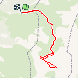
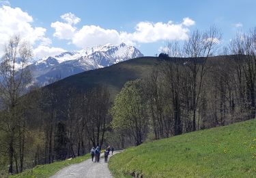
Trail Walking of 11.2 km to be discovered at Occitania, Hautespyrenees, Arras-en-Lavedan. This trail is proposed by pffrench.

Description

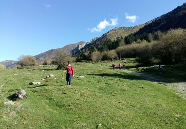
problème de choix itineraires . prendre celui du retour, indiqué par las punaises rouges, "tracé confortable".
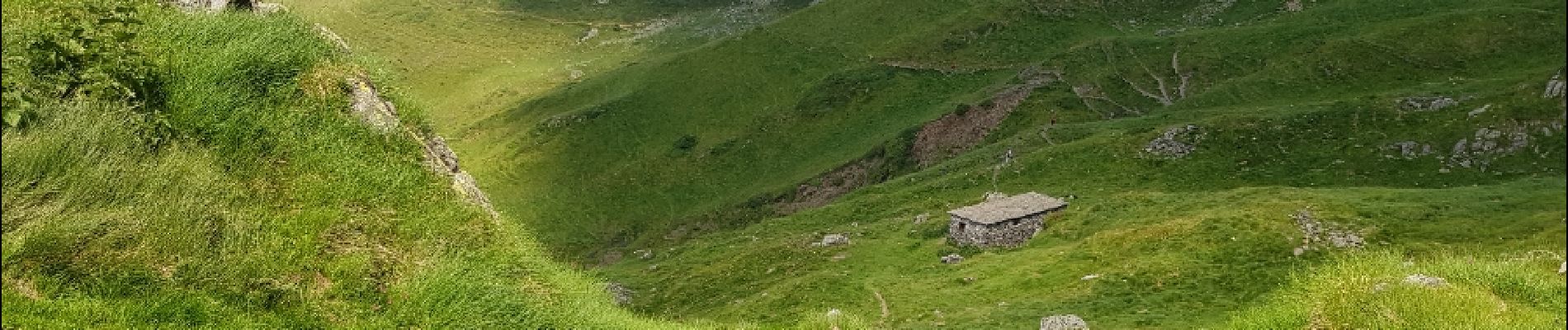
Par ailleurs, magnifique table d'orientation au sommet.
Eviter de se faire prendre par la mer de nuages, l'identification du chemin dans le brouillard peut etre difficile.

Elevation profile

Photos

Points of interest

Point of interest Arcizans-Avant - Tracé confortable - Photo
pffrench
ARCIZANS-AVANT 
Point of interest Arcizans-Avant - Tracé confortable - Photo
pffrench
ARCIZANS-AVANT 
Point of interest Arcizans-Avant - Tracé confortable - Photo
pffrench
ARCIZANS-AVANT 

Positioning

Country:
France
Region :
Occitania
Department/Province :
Hautespyrenees
Municipality :
Arras-en-Lavedan
Location:
Unknown
Start:(UTM)
732829 ; 4759465 (30T) N.

Trails nearby

Trail Walking Arcizans-Dessus - la fontaine de Nabias - Photo
Walking
bernardbelmas

Walking

Very easy
(1)
Arcizans-Dessus, Occitania, Hautespyrenees, France
4.2 km | 6.8 km-effort
1h 40min
Yes
Trail Snowshoes Aucun - Le Soum de Berducou - Photo
Snowshoes
tracegps

Snowshoes

Medium
(1)
Aucun, Occitania, Hautespyrenees, France
5.3 km | 9.6 km-effort
3h 15min
Yes
Trail Walking Estaing - Les Viellettes - Estaing - Photo
Walking
tracegps

Walking

Difficult
(1)
Estaing, Occitania, Hautespyrenees, France
13.1 km | 24 km-effort
4h 0min
Yes
Trail Walking Gaillagos - GAILLAGOS / Couret / Couraduque en boucle reco G3 - Photo
Walking
GUIDE
marmotte65

Walking

Difficult
Gaillagos, Occitania, Hautespyrenees, France
8.4 km | 14.3 km-effort
2h 30min
Yes
Trail On foot Aucun - AUCUN Couraduque  Le Berbeillet autrement G3 2976337 - Photo
On foot
GUIDE
marmotte65

On foot

Easy
Aucun, Occitania, Hautespyrenees, France
9.5 km | 14.2 km-effort
2h 13min
Yes
Trail Winter sports Aucun - couraduc soulor - Photo
Winter sports
ehresmann

Winter sports

Difficult
(1)
Aucun, Occitania, Hautespyrenees, France
34 km | 45 km-effort
2h 31min
Yes
Trail Winter sports Aucun - Bazes soulor - Photo
Winter sports
ehresmann

Winter sports

Medium
(1)
Aucun, Occitania, Hautespyrenees, France
25 km | 34 km-effort
2h 4min
Yes
Trail Walking Gaillagos - GAILLAGOS Col de Couret Couraduque en boucle G3 du 21/04/2023
Walking
GUIDE
marmotte65

Walking

Difficult
Gaillagos, Occitania, Hautespyrenees, France
8.2 km | 14.2 km-effort
2h 46min
Yes
Trail Walking Estaing - ESTAING autour du lac - Photo
Walking
GUIDE
marmotte65

Walking

Easy
Estaing, Occitania, Hautespyrenees, France
3.7 km | 5.3 km-effort
1h 9min
Yes


Close
My subscriptions