Trail Walking Plabennec - De Plabennec au Folgoët - Photo

De Plabennec au Folgoët

 tracegps
tracegps

User

© OpenStreetMap contributors
Length
Length
13.8 km
Max alt
Max alt
88 m
Uphill gradient
Uphill gradient
104 m
Km-Effort
Km-Effort  
15.2 km
Min alt
Min alt
29 m
Downhill gradient
Downhill gradient
128 m
Boucle
Boucle
No
Creation date :
2014-12-10 00:00:00.0
Updated on :
2014-12-10 00:00:00.0

(0 Reviews)

Walking
Walking
4h00
Difficulty : Difficult

Scan this QR Code to open this trail in the SityTrail application

FREE GPS app for hiking

Logo SityTrail SityTrail

IGN / Geographical institutes

Download SityTrail from the App Store Download SityTrail from Google Play

Logo SityTrail SityTrail World

The world is yours!

Download SityTrail from the App Store Download SityTrail from Google Play Download SityTrail on Huawei AppGallery

About

Trail Walking of 13.8 km to be discovered at Brittany, Finistère, Plabennec. This trail is proposed by tracegps.

Description

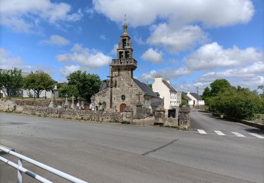
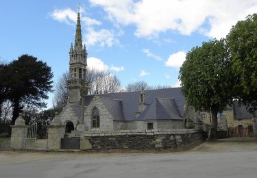
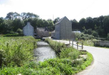
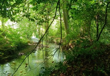
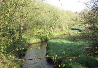
Franchissant ou longeant les vallées de l'Aber-Benoît et de l'Aber-Wrac'h, ce chemin permet de découvrir le patrimoine local, la chapelle de Locmaria-Lann et son petit calvaire, la chapelle de Landouzen et ses légendes. La description du chemin est disponible sur le site chemins-bretagne.com

Elevation profile

Photos

Positioning

Country:
France
Region :
Brittany
Department/Province :
Finistère
Municipality :
Plabennec
Location:
Unknown
Start:(UTM)
394439 ; 5372414 (30U) N.

Trails nearby

Trail Walking Kersaint-Plabennec - Coulée verte a Kersaint-Plabennec - Photo
Walking
petitbuzuc

Walking

Very easy
(1)
Kersaint-Plabennec, Brittany, Finistère, France
2.6 km | 2.8 km-effort
58min
Yes
Trail Walking Plouvien - Autour de Plouvien - Photo
Walking
tracegps

Walking

Medium
(1)
Plouvien, Brittany, Finistère, France
13.8 km | 15.8 km-effort
3h 0min
Yes
Trail Mountain bike Plabennec - Vtt à Plabennec 22km - Photo
Mountain bike
tracegps

Mountain bike

Medium
(2)
Plabennec, Brittany, Finistère, France
21 km | 24 km-effort
2h 0min
Yes
Trail Nordic walking Le Drennec - le drennec Loc brevelaire - Photo
Nordic walking
elianette

Nordic walking

Very easy
Le Drennec, Brittany, Finistère, France
13 km | 14.6 km-effort
2h 48min
Yes
Trail On foot Plouvien - Rand'Abers 11 - Photo
On foot
PRO

On foot

Easy
Plouvien, Brittany, Finistère, France
17 km | 19.3 km-effort
4h 22min
Yes
Trail Mountain bike Plabennec - Circuit des Moulins à Plouvien - Photo
Mountain bike
tracegps

Mountain bike

Difficult
Plabennec, Brittany, Finistère, France
23 km | 27 km-effort
2h 30min
Yes
Trail Walking Plouvien - plouviens - Photo
Walking
elianette

Walking

Difficult
Plouvien, Brittany, Finistère, France
14 km | 15.7 km-effort
2h 12min
Yes
Trail Nordic walking Le Drennec - le drenec. Loc brevelaire  - Photo
Nordic walking
elianette

Nordic walking

Very easy
Le Drennec, Brittany, Finistère, France
17.6 km | 21 km-effort
3h 43min
Yes
Trail Walking Le Drennec - De Le Drennec à Lannilis le long de l'Aber Wrac'h - Photo
Walking
tracegps

Walking

Difficult
(1)
Le Drennec, Brittany, Finistère, France
19.4 km | 24 km-effort
4h 30min
No


Close
My subscriptions