


Refuge du Mont Pourri

cron
User
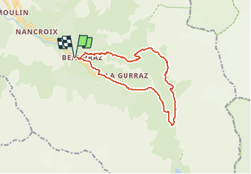

Length
14.1 km

Max alt
2467 m

Uphill gradient
980 m
Km-Effort
27 km

Min alt
1525 m

Downhill gradient
980 m
Boucle
Yes
Creation date :
2019-01-15 13:58:40.366
Updated on :
2019-01-15 13:58:40.366
5h25
Difficulty : Difficult

FREE GPS app for hiking
 SityTrail
IGN / Geographical institutes
SityTrail Plus
The world is yours!
About
Trail Walking of 14.1 km to be discovered at Auvergne-Rhône-Alpes, Savoy, Peisey-Nancroix. This trail is proposed by cron.
Positioning
Country:
France
Region :
Auvergne-Rhône-Alpes
Department/Province :
Savoy
Municipality :
Peisey-Nancroix
Location:
Unknown
Start:(Dec)
Start:(UTM)
327487 ; 5043630 (32T) N.
Comments