


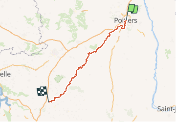
05_GR Poitiers - Saint Jean d'Angély

Lucquiaud
User

Length
152 km

Max alt
180 m

Uphill gradient
1487 m
Km-Effort
172 km

Min alt
13 m

Downhill gradient
1588 m
Boucle
No
Creation date :
2018-09-15 15:01:39.629
Updated on :
2018-09-15 15:01:40.626
37h58
Difficulty : Unknown

FREE GPS app for hiking
 SityTrail
IGN / Geographical institutes
SityTrail Plus
The world is yours!
About
Trail Mountain bike of 152 km to be discovered at New Aquitaine, Vienne, Poitiers. This trail is proposed by Lucquiaud.
Positioning
Country:
France
Region :
New Aquitaine
Department/Province :
Vienne
Municipality :
Poitiers
Location:
Unknown
Start:(Dec)
Start:(UTM)
296432 ; 5162506 (31T) N.
Comments