


abbaye de Puypéroux 04-08-2018

jmrobin
User
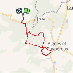

Length
7 km

Max alt
188 m

Uphill gradient
158 m
Km-Effort
9.1 km

Min alt
109 m

Downhill gradient
160 m
Boucle
Yes
Creation date :
2019-03-04 10:37:27.054
Updated on :
2019-03-04 10:37:27.082
1h55
Difficulty : Easy

FREE GPS app for hiking
 SityTrail
IGN / Geographical institutes
SityTrail Plus
The world is yours!
About
Trail Walking of 7 km to be discovered at New Aquitaine, Charente, Montmoreau. This trail is proposed by jmrobin.
Positioning
Country:
France
Region :
New Aquitaine
Department/Province :
Charente
Municipality :
Montmoreau
Location:
Unknown
Start:(Dec)
Start:(UTM)
275005 ; 5038417 (31T) N.
Comments