Trail Mountain bike Granges-Narboz - Espace VTT FFC les Monts D'Arlier -n° 081 - Les Granges Dessus - Photo

Espace VTT FFC les Monts D'Arlier -n° 081 - Les Granges Dessus

 tracegps
tracegps

User

© OpenStreetMap contributors
Length
Length
8.5 km
Max alt
Max alt
1029 m
Uphill gradient
Uphill gradient
225 m
Km-Effort
Km-Effort  
11.6 km
Min alt
Min alt
930 m
Downhill gradient
Downhill gradient
230 m
Boucle
Boucle
Yes
Creation date :
2014-12-10 00:00:00.0
Updated on :
2014-12-10 00:00:00.0

(0 Reviews)

Mountain bike
Mountain bike
1h00
Difficulty : Medium

Scan this QR Code to open this trail in the SityTrail application

FREE GPS app for hiking

Logo SityTrail SityTrail

IGN / Geographical institutes

Download SityTrail from the App Store Download SityTrail from Google Play

Logo SityTrail SityTrail World

The world is yours!

Download SityTrail from the App Store Download SityTrail from Google Play Download SityTrail on Huawei AppGallery

About

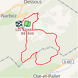
Trail Mountain bike of 8.5 km to be discovered at Bourgogne-Franche-Comté, Doubs, Granges-Narboz. This trail is proposed by tracegps.

Description

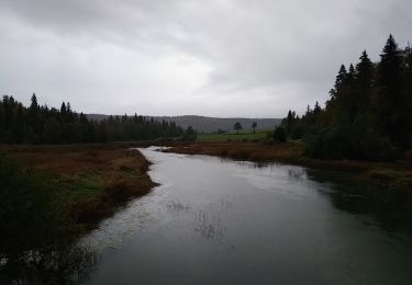
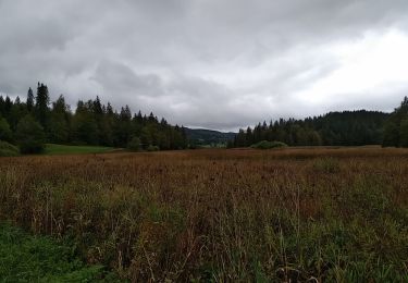
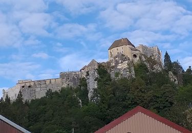
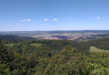
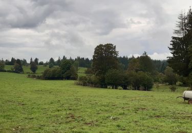
Espace VTT FFC les Monts D'Arlier - Château de Joux Circuit labellisé par la Fédération Française de Cyclisme. Ce circuit vous emmène à travers forêts, prés, bois et pâturages, à la découverte de la montagne du Laveron.

Elevation profile

Photos

Positioning

Country:
France
Region :
Bourgogne-Franche-Comté
Department/Province :
Doubs
Municipality :
Granges-Narboz
Location:
Unknown
Start:(UTM)
296010 ; 5194546 (32T) N.

Trails nearby

Trail On foot Les Grangettes - La Pierre qui Tourne - Photo
On foot
PRO

On foot

Easy
Les Grangettes, Bourgogne-Franche-Comté, Doubs, France
8.2 km | 10.7 km-effort
2h 25min
Yes
Trail On foot Malpas - Le Tour du Lac de Malpas - Photo
On foot
PRO

On foot

Easy
Malpas, Bourgogne-Franche-Comté, Doubs, France
4.9 km | 5.7 km-effort
1h 17min
Yes
Trail Walking Montperreux - Chaon Saint Point - Lac - Photo
Walking
helmut68

Walking

Easy
(1)
Montperreux, Bourgogne-Franche-Comté, Doubs, France
15.1 km | 19.4 km-effort
3h 5min
Yes
Trail Walking Montperreux - Sentier de la découverte - Chaon Malbuisson - Photo
Walking
helmut68

Walking

Easy
Montperreux, Bourgogne-Franche-Comté, Doubs, France
9.8 km | 12.3 km-effort
2h 12min
Yes
Trail Walking Montperreux -                                     La Gouille - Photo
Walking
helmut68

Walking

Easy
Montperreux, Bourgogne-Franche-Comté, Doubs, France
8 km | 10.1 km-effort
1h 53min
Yes
Trail Walking Montperreux - La source bleue - Photo
Walking
helmut68

Walking

Easy
Montperreux, Bourgogne-Franche-Comté, Doubs, France
9.8 km | 13.4 km-effort
2h 13min
Yes
Trail Walking La Cluse-et-Mijoux - le grand taureau, la Cluse et Mijoux - Photo
Walking
eltonnermou

Walking

Medium
La Cluse-et-Mijoux, Bourgogne-Franche-Comté, Doubs, France
24 km | 34 km-effort
5h 26min
Yes
Trail Walking Pontarlier - le grand taureau, Pontarlier - Photo
Walking
eltonnermou

Walking

Difficult
Pontarlier, Bourgogne-Franche-Comté, Doubs, France
20 km | 29 km-effort
3h 36min
Yes
Trail Walking La Cluse-et-Mijoux - GTJ 2 La Cluse et Mijoux, Metabief - Photo
Walking
Praff

Walking

Medium
La Cluse-et-Mijoux, Bourgogne-Franche-Comté, Doubs, France
21 km | 29 km-effort
6h 18min
No


Close
My subscriptions