Trail Mountain bike Tréméven - Espace VTT FFC de Cornouaille - Circuit n°33 - Tréméven - Photo

Espace VTT FFC de Cornouaille - Circuit n°33 - Tréméven

 tracegps
tracegps

User

© OpenStreetMap contributors
Length
Length
15.4 km
Max alt
Max alt
97 m
Uphill gradient
Uphill gradient
241 m
Km-Effort
Km-Effort  
18.6 km
Min alt
Min alt
28 m
Downhill gradient
Downhill gradient
241 m
Boucle
Boucle
Yes
Creation date :
2014-12-10 00:00:00.0
Updated on :
2014-12-10 00:00:00.0

(0 Reviews)

Mountain bike
Mountain bike
1h19
Difficulty : Medium

Scan this QR Code to open this trail in the SityTrail application

FREE GPS app for hiking

Logo SityTrail SityTrail

IGN / Geographical institutes

Download SityTrail from the App Store Download SityTrail from Google Play

Logo SityTrail SityTrail World

The world is yours!

Download SityTrail from the App Store Download SityTrail from Google Play Download SityTrail on Huawei AppGallery

About

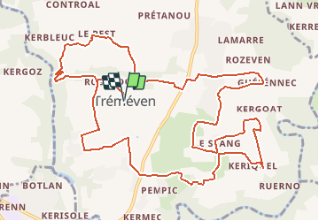
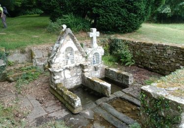
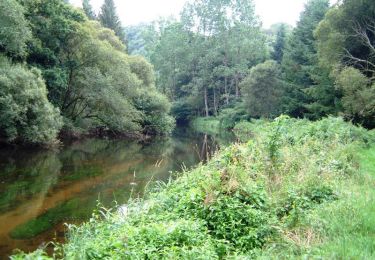
Trail Mountain bike of 15.4 km to be discovered at Brittany, Finistère, Tréméven. This trail is proposed by tracegps.

Description

Espace VTT FFC de Cornouaille Circuit labellisé par la Fédération Française de Cyclisme. La commune de Tréméven est entourée de rivières. Cette situation lui permet d’avoir des circuits de VTT très intéressant avec un dénivelé à ne pas négliger. Une liaison est possible avec les circuits se trouvant sur Mellac, commune située sur l’autre rive de l’Isole. Possibilité de rallonger la boucle en se raccrochant sur les circuits 34 ou 35.

Elevation profile

Photos

Positioning

Country:
France
Region :
Brittany
Department/Province :
Finistère
Municipality :
Tréméven
Location:
Unknown
Start:(UTM)
460142 ; 5305182 (30T) N.

Trails nearby

Trail Walking Tréméven - Trémeven kermec  - Photo
Walking
dlenaour56

Walking

Easy
Tréméven, Brittany, Finistère, France
8.2 km | 10.3 km-effort
2h 9min
Yes
Trail Walking Quimperlé - laita vers guides plage - Photo
Walking
francejpp

Walking

Easy
(1)
Quimperlé, Brittany, Finistère, France
16.1 km | 20 km-effort
2h 40min
No
Trail Walking Locunolé - LOCUNOLÉ - Photo
Walking
RonanDAGORN

Walking

Difficult
Locunolé, Brittany, Finistère, France
23 km | 30 km-effort
5h 38min
Yes
Trail Walking Locunolé - LOCUNOLÉ - Photo
Walking
RonanDAGORN

Walking

Difficult
Locunolé, Brittany, Finistère, France
23 km | 30 km-effort
5h 38min
Yes
Trail Mountain bike Mellac - Espace VTT FFC de Cornouaille - Circuit n°38 - Mellac - Photo
Mountain bike
tracegps

Mountain bike

Difficult
Mellac, Brittany, Finistère, France
12.6 km | 15.4 km-effort
1h 15min
Yes
Trail Walking Mellac - mellac mellac - Photo
Walking
JEAN06910

Walking

Very difficult
Mellac, Brittany, Finistère, France
24 km | 30 km-effort
6h 33min
No
Trail Bicycle tourism Quimperlé - mellac - Photo
Bicycle tourism
Didier Collet

Bicycle tourism

Easy
Quimperlé, Brittany, Finistère, France
27 km | 30 km-effort
1h 56min
No
Trail Walking Mellac - Vallée de l’isole - Photo
Walking
ricoux

Walking

Difficult
(1)
Mellac, Brittany, Finistère, France
11.3 km | 13.6 km-effort
3h 20min
Yes
Trail On foot Quimperlé - 09/02/2024 - QUIMPERLE, l'Ysole, l'Ellé, la Laïta...Virtuel - Photo
On foot
babeth35

On foot

Easy
Quimperlé, Brittany, Finistère, France
3.7 km | 4.5 km-effort
1h 0min
Yes


Close
My subscriptions