Trail Mountain bike Mellac - Espace VTT FFC de Cornouaille - Circuit n°38 - Mellac - Photo

Espace VTT FFC de Cornouaille - Circuit n°38 - Mellac

 tracegps
tracegps

User

© OpenStreetMap contributors
Length
Length
12.6 km
Max alt
Max alt
96 m
Uphill gradient
Uphill gradient
213 m
Km-Effort
Km-Effort  
15.4 km
Min alt
Min alt
15 m
Downhill gradient
Downhill gradient
214 m
Boucle
Boucle
Yes
Creation date :
2014-12-10 00:00:00.0
Updated on :
2014-12-10 00:00:00.0

(0 Reviews)

Mountain bike
Mountain bike
1h15
Difficulty : Difficult

Scan this QR Code to open this trail in the SityTrail application

FREE GPS app for hiking

Logo SityTrail SityTrail

IGN / Geographical institutes

Download SityTrail from the App Store Download SityTrail from Google Play

Logo SityTrail SityTrail World

The world is yours!

Download SityTrail from the App Store Download SityTrail from Google Play Download SityTrail on Huawei AppGallery

About

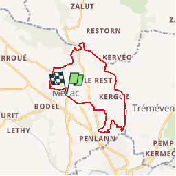
Trail Mountain bike of 12.6 km to be discovered at Brittany, Finistère, Mellac. This trail is proposed by tracegps.

Description

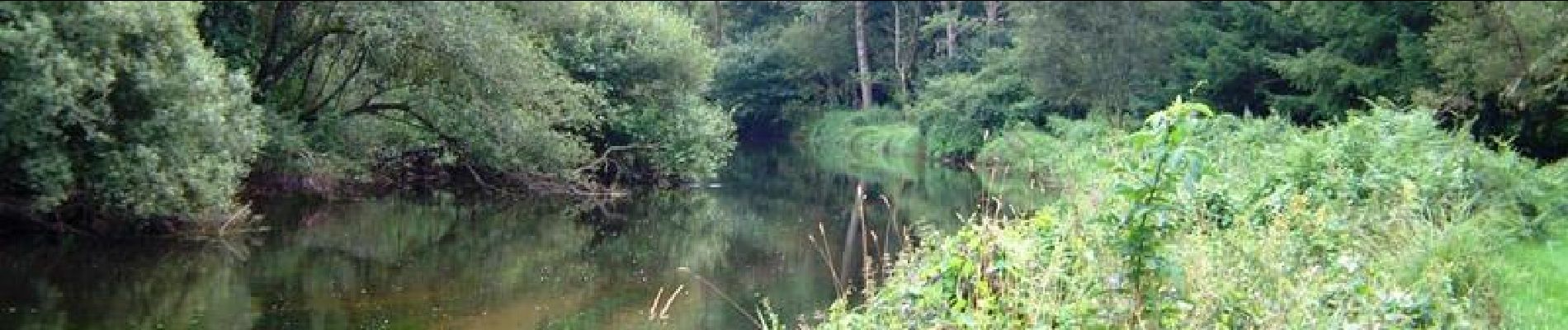
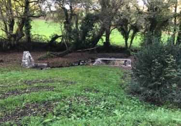
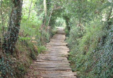
Espace VTT FFC de Cornouaille Circuit labellisé par la Fédération Française de Cyclisme. Parcours à travers la campagne, à la découverte de la rivière Isole, à partir du bourg de Mellac. En cours de chemin, en traversant l’Isole, possibilité de rattraper les boucles de Tréméven. Au retour du circuit N° 38, possibilité de faire la boucle N° 36 qui vous emmènera à la découverte du Manoir de Kernault.

Elevation profile

Photos

Positioning

Country:
France
Region :
Brittany
Department/Province :
Finistère
Municipality :
Mellac
Location:
Unknown
Start:(UTM)
456900 ; 5305734 (30T) N.

Trails nearby

Trail Walking Tréméven - Trémeven kermec  - Photo
Walking
dlenaour56

Walking

Easy
Tréméven, Brittany, Finistère, France
8.2 km | 10.3 km-effort
2h 9min
Yes
Trail Mountain bike Tréméven - Espace VTT FFC de Cornouaille - Circuit n°33 - Tréméven - Photo
Mountain bike
tracegps

Mountain bike

Medium
Tréméven, Brittany, Finistère, France
15.4 km | 18.6 km-effort
1h 19min
Yes
Trail Walking Mellac - mellac mellac - Photo
Walking
JEAN06910

Walking

Very difficult
Mellac, Brittany, Finistère, France
24 km | 30 km-effort
6h 33min
No
Trail Bicycle tourism Quimperlé - mellac - Photo
Bicycle tourism
Didier Collet

Bicycle tourism

Easy
Quimperlé, Brittany, Finistère, France
27 km | 30 km-effort
1h 56min
No
Trail Walking Mellac - Vallée de l’isole - Photo
Walking
ricoux

Walking

Difficult
(1)
Mellac, Brittany, Finistère, France
11.3 km | 13.6 km-effort
3h 20min
Yes
Trail On foot Quimperlé - 09/02/2024 - QUIMPERLE, l'Ysole, l'Ellé, la Laïta...Virtuel - Photo
On foot
babeth35

On foot

Easy
Quimperlé, Brittany, Finistère, France
3.7 km | 4.5 km-effort
1h 0min
Yes
Trail Running Tréméven - jenni 1 - Photo
Running
apa

Running

Medium
Tréméven, Brittany, Finistère, France
8 km | 9.7 km-effort
56min
Yes
Trail Walking Mellac - MELLAC - moulin blanc - Photo
Walking
patrouve

Walking

Medium
(1)
Mellac, Brittany, Finistère, France
8.5 km | 10.2 km-effort
2h 12min
Yes
Trail Walking Tréméven - Tréméven - Photo
Walking
patrouve

Walking

Medium
Tréméven, Brittany, Finistère, France
8.9 km | 11 km-effort
2h 22min
Yes


Close
My subscriptions