Trail Mountain bike Aragon - Centre VTT - FFC Cabardes - Pays Cathare - Circuit n° 04 - Photo

Centre VTT - FFC Cabardes - Pays Cathare - Circuit n° 04

 tracegps
tracegps

User

© OpenStreetMap contributors
Length
Length
16.4 km
Max alt
Max alt
351 m
Uphill gradient
Uphill gradient
258 m
Km-Effort
Km-Effort  
19.9 km
Min alt
Min alt
180 m
Downhill gradient
Downhill gradient
257 m
Boucle
Boucle
Yes
Creation date :
2014-12-10 00:00:00.0
Updated on :
2014-12-10 00:00:00.0

(0 Reviews)

Mountain bike
Mountain bike
1h15
Difficulty : Easy

Scan this QR Code to open this trail in the SityTrail application

FREE GPS app for hiking

Logo SityTrail SityTrail

IGN / Geographical institutes

Download SityTrail from the App Store Download SityTrail from Google Play

Logo SityTrail SityTrail World

The world is yours!

Download SityTrail from the App Store Download SityTrail from Google Play Download SityTrail on Huawei AppGallery

About

Trail Mountain bike of 16.4 km to be discovered at Occitania, Aude, Aragon. This trail is proposed by tracegps.

Description

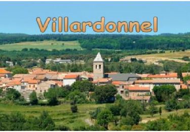
Centre VTT - FFC Cabardes – Pays Cathare Circuit officiel labellisé par la Fédération Française de Cyclisme. Le village et ses abords bénéficient d'une protection au titre de la législation sur les sites, depuis 1974. Aragon est établi sur un éperon rocheux isolé. Bâti en amphithéâtre, il domine les ruisseaux du "Trapel" et de "La Valette", ainsi que les nombreux jardins potagers et autres espaces ouverts tels que la promenade des Oliviers, au Nord. Source Aragon en Cabardes

Elevation profile

Photos

Positioning

Country:
France
Region :
Occitania
Department/Province :
Aude
Municipality :
Aragon
Location:
Unknown
Start:(UTM)
444168 ; 4793948 (31T) N.

Trails nearby

Trail Walking Villardonnel - Balade autour de Gleyre - Villardonnel - Photo
Walking
tracegps

Walking

Medium
(1)
Villardonnel, Occitania, Aude, France
6.4 km | 9.4 km-effort
2h 30min
Yes
Trail Walking Aragon - GARILLE - FONT DE L'ORME - GARILLE - Photo
Walking
Combaut11

Walking

Medium
(1)
Aragon, Occitania, Aude, France
6 km | 7.4 km-effort
1h 41min
Yes
Trail Walking Villegailhenc - Villegailhenc Conques Aragon - Photo
Walking
GUIDE
Ada11

Walking

Medium
Villegailhenc, Occitania, Aude, France
23 km | 29 km-effort
5h 45min
Yes
Trail On foot Conques-sur-Orbiel - Conques-Les Capitelles - Photo
On foot
dufland

On foot

Easy
(2)
Conques-sur-Orbiel, Occitania, Aude, France
6.4 km | 7.7 km-effort
2h 30min
Yes
Trail Walking Conques-sur-Orbiel - village celte - Photo
Walking
oliviercaty

Walking

Easy
(1)
Conques-sur-Orbiel, Occitania, Aude, France
3.9 km | 4.8 km-effort
1h 48min
Yes
Trail Walking Conques-sur-Orbiel - Conques-Les Capitelles 5.6 - Photo
Walking
dufland

Walking

Medium
(1)
Conques-sur-Orbiel, Occitania, Aude, France
5.5 km | 6.6 km-effort
1h 31min
Yes
Trail Walking Ventenac-Cabardès - Ventenac, La Ventaillole, Le Sauvage - Photo
Walking
mikaou.t

Walking

Medium
(1)
Ventenac-Cabardès, Occitania, Aude, France
10.7 km | 13 km-effort
1h 38min
Yes
Trail Walking Aragon - Garille - Aragon - Photo
Walking
mikaou.t

Walking

Easy
(1)
Aragon, Occitania, Aude, France
9.3 km | 11.6 km-effort
2h 30min
Yes
Trail Walking Aragon - Aragon - Photo
Walking
JohnTompa

Walking

Very easy
(1)
Aragon, Occitania, Aude, France
9.3 km | 11.3 km-effort
Unknown
Yes


Close
My subscriptions