


mollau gazon vert col des perches variante_wpt_trk

JCLUTT
User
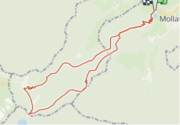

Length
11.8 km

Max alt
1102 m

Uphill gradient
747 m
Km-Effort
22 km

Min alt
471 m

Downhill gradient
747 m
Boucle
Yes
Creation date :
2019-05-21 17:17:04.867
Updated on :
2021-05-26 12:22:57.22
--
Difficulty : Difficult

FREE GPS app for hiking
 SityTrail
IGN / Geographical institutes
SityTrail Plus
The world is yours!
About
Trail Walking of 11.8 km to be discovered at Grand Est, Haut-Rhin, Mollau. This trail is proposed by JCLUTT.


Positioning
Country:
France
Region :
Grand Est
Department/Province :
Haut-Rhin
Municipality :
Mollau
Location:
Unknown
Start:(Dec)
Start:(UTM)
348085 ; 5304158 (32T) N.
Comments