Trail Walking Montségur - la Frau - Photo
 j2c11
j2c11

User

© OpenStreetMap contributors
Length
Length
19.3 km
Max alt
Max alt
1916 m
Uphill gradient
Uphill gradient
1146 m
Km-Effort
Km-Effort  
35 km
Min alt
Min alt
926 m
Downhill gradient
Downhill gradient
1154 m
Boucle
Boucle
Yes
Creation date :
2018-08-23 19:14:00.204
Updated on :
2018-08-23 19:14:00.204

(0 Reviews)

Walking
Walking
6h59
Difficulty : Medium

Scan this QR Code to open this trail in the SityTrail application

FREE GPS app for hiking

Logo SityTrail SityTrail

IGN / Geographical institutes

Download SityTrail from the App Store Download SityTrail from Google Play

Logo SityTrail SityTrail World

The world is yours!

Download SityTrail from the App Store Download SityTrail from Google Play Download SityTrail on Huawei AppGallery

About

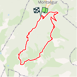
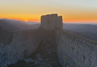
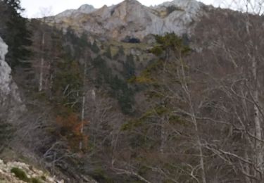
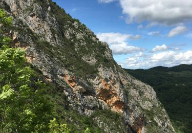
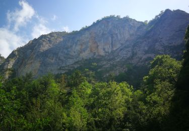
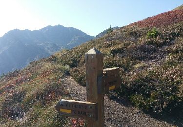
Trail Walking of 19.3 km to be discovered at Occitania, Ariège, Montségur. This trail is proposed by j2c11.

Description

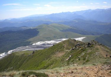
Grande boucle pour aller à la Frau.
Montée par le Lasset et la jasse de Pratmau. Col de la peyre et la Frau.
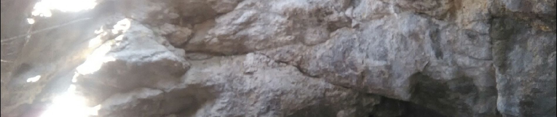
Redescente direct par les crêtes sur Montségur en passant par la grotte de la Caunha.

Elevation profile

Photos

Positioning

Country:
France
Region :
Occitania
Department/Province :
Ariège
Municipality :
Montségur
Location:
Unknown
Start:(UTM)
404067 ; 4745708 (31T) N.

Trails nearby

Trail Walking Montségur - Pic de Saint Barthélemy - Pic de Soularac - Photo
Walking
tracegps

Walking

Difficult
(1)
Montségur, Occitania, Ariège, France
12.7 km | 27 km-effort
6h 0min
Yes
Trail Walking Montferrier - découverte du château de montsegur et du village par montferroer - Photo
Walking
fab0202

Walking

Medium
Montferrier, Occitania, Ariège, France
12.6 km | 21 km-effort
3h 42min
Yes
Trail Walking Montferrier - Sentier cathare - Château de Montsegur - Photo
Walking
toutankhcarton

Walking

Medium
Montferrier, Occitania, Ariège, France
12.6 km | 21 km-effort
4h 48min
Yes
Trail Walking Montségur - 03 et 04 - MONTSEGUR COMUS SORGEAT - Chemin des Bons-Hommes  GR107 - Photo
Walking
jopost

Walking

Difficult
Montségur, Occitania, Ariège, France
35 km | 56 km-effort
11h 22min
No
Trail Walking Montségur - Sentier Cathare - De Montségur à Comus - Photo
Walking
tracegps

Walking

Difficult
Montségur, Occitania, Ariège, France
13.2 km | 23 km-effort
5h 30min
No
Trail Other activity Montségur - roc punchut grotte des foyers - Photo
Other activity
jl-torrecillas

Other activity

Very easy
Montségur, Occitania, Ariège, France
2.3 km | 4.4 km-effort
38min
No
Trail Walking Montségur - Village et châteaux de Montségur - Photo
Walking
ezola

Walking

Medium
Montségur, Occitania, Ariège, France
4.4 km | 8.4 km-effort
1h 34min
No
Trail Walking Fougax-et-Barrineuf - gorge de la Frau - Photo
Walking
antoine57

Walking

Very easy
Fougax-et-Barrineuf, Occitania, Ariège, France
27 km | 36 km-effort
2h 0min
No
Trail Walking Montferrier - MOULZOUNE l'étang à l'Etang des Truites - Photo
Walking
jopost

Walking

Medium
Montferrier, Occitania, Ariège, France
11.2 km | 21 km-effort
5h 18min
Yes


Close
My subscriptions