Trail Mountain bike Domfront en Poiraie - Espace VTT FFC les Ecureuils du Domfrontais - Circuit n°10 - La Nocherie - Photo

Espace VTT FFC les Ecureuils du Domfrontais - Circuit n°10 - La Nocherie

 tracegps
tracegps

User

© OpenStreetMap contributors
Length
Length
21 km
Max alt
Max alt
263 m
Uphill gradient
Uphill gradient
413 m
Km-Effort
Km-Effort  
26 km
Min alt
Min alt
137 m
Downhill gradient
Downhill gradient
415 m
Boucle
Boucle
Yes
Creation date :
2014-12-10 00:00:00.0
Updated on :
2014-12-10 00:00:00.0

(0 Reviews)

Mountain bike
Mountain bike
3h00
Difficulty : Medium

Scan this QR Code to open this trail in the SityTrail application

FREE GPS app for hiking

Logo SityTrail SityTrail

IGN / Geographical institutes

Download SityTrail from the App Store Download SityTrail from Google Play

Logo SityTrail SityTrail World

The world is yours!

Download SityTrail from the App Store Download SityTrail from Google Play Download SityTrail on Huawei AppGallery

About

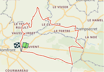
Trail Mountain bike of 21 km to be discovered at Normandy, Orne, Domfront en Poiraie. This trail is proposed by tracegps.

Description

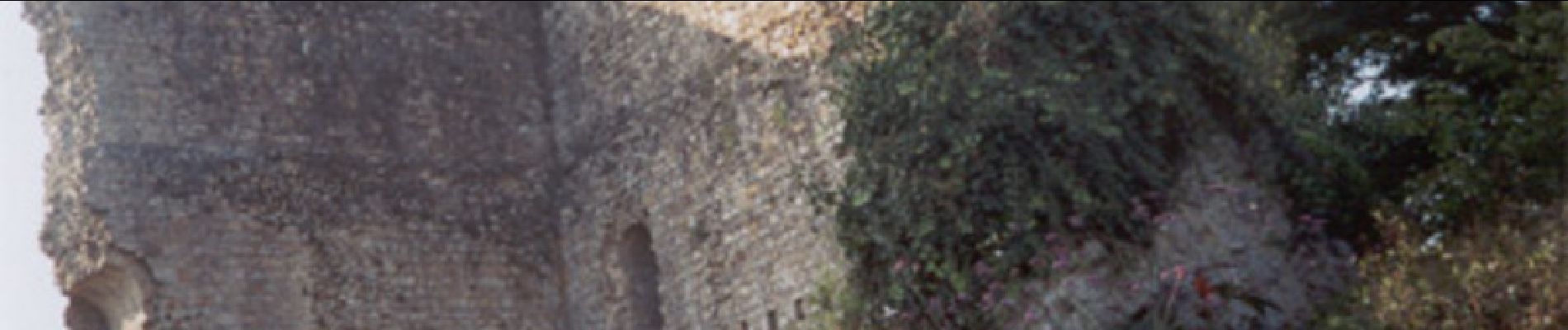
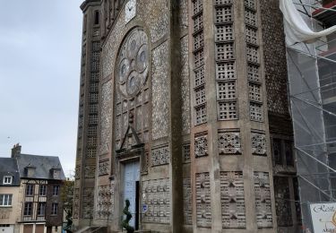
Espace VTT - FFC Les Ecureuils du Domfrontais Circuit officiel labellisé par la Fédération Française de Cyclisme. Bénéficiant d'un site naturel privilégié, la ville de Domfront offre un panorama exceptionnel sur un large horizon bocager. L'origine de la ville remonte au XIe siècle. C'est vers 1010 que fut élevée la première fortification, sur un promontoire de grès qui domine les gorges de la Varenne. Entourée de fossés profonds, cette redoutable forteresse fut entourée d'un mur d'enceinte par Guillaume de Talvas. Il reste les vestiges d'une porte d'entrée accolée au donjon. A l'abri de ses murs étaient conservés trésors, archives et armes. D'une position stratégique indéniable, le château de Domfront fut, durant des siècles, l'un des plus puissants donjons de France.

Elevation profile

Photos

Positioning

Country:
France
Region :
Normandy
Department/Province :
Orne
Municipality :
Domfront en Poiraie
Location:
Domfront
Start:(UTM)
674876 ; 5384761 (30U) N.

Trails nearby

Trail Walking Domfront en Poiraie - La Chapelle du Cérisier  - Domfront - Photo
Walking
tracegps

Walking

Medium
Domfront en Poiraie, Normandy, Orne, France
12.4 km | 15.4 km-effort
3h 0min
Yes
Trail Mountain bike Domfront en Poiraie - Espace VTT FFC les Ecureuils du Domfrontais - Circuit n°07 - Saint Bômer Les Forges - Photo
Mountain bike
tracegps

Mountain bike

Difficult
Domfront en Poiraie, Normandy, Orne, France
23 km | 29 km-effort
3h 0min
Yes
Trail Walking Domfront en Poiraie - dontfront - Photo
Walking
Jluc02

Walking

Easy
Domfront en Poiraie, Normandy, Orne, France
2.4 km | 3 km-effort
1h 3min
Yes
Trail Cycle Domfront en Poiraie - La Vélo Francette de Domfront par Saint Fraimbault - Photo
Cycle
neoroll44

Cycle

Easy
Domfront en Poiraie, Normandy, Orne, France
26 km | 29 km-effort
3h 0min
No
Trail Walking Domfront en Poiraie - Domfront circuit Pittoresque Site Monts et Marches - Photo
Walking
neoroll44

Walking

Easy
Domfront en Poiraie, Normandy, Orne, France
3.7 km | 5 km-effort
1h 10min
Yes
Trail Bicycle tourism Domfront en Poiraie -  Véloscénie Domfront - Mortain - Photo
Bicycle tourism
famiski

Bicycle tourism

Very easy
Domfront en Poiraie, Normandy, Orne, France
35 km | 39 km-effort
2h 40min
No
Trail Walking Domfront en Poiraie - Domfront / la Fosse Arthour par GR 22 - Photo
Walking
mimisouge72

Walking

Easy
Domfront en Poiraie, Normandy, Orne, France
41 km | 49 km-effort
6h 15min
No
Trail Bicycle tourism Domfront en Poiraie - Activity - Photo
Bicycle tourism
Ceclm

Bicycle tourism

Medium
Domfront en Poiraie, Normandy, Orne, France
34 km | 39 km-effort
Unknown
No
Trail Other activity Domfront en Poiraie - Basse Normandie - Ligne 437 - Domfront - Pontaubault  - Photo
Other activity
mich54

Other activity

Very easy
Domfront en Poiraie, Normandy, Orne, France
62 km | 68 km-effort
5min
No


Close
My subscriptions