Trail Mountain bike Laragne-Montéglin - Laragne 2008 - Photo
 tracegps
tracegps

User

© OpenStreetMap contributors
Length
Length
35 km
Max alt
Max alt
911 m
Uphill gradient
Uphill gradient
907 m
Km-Effort
Km-Effort  
47 km
Min alt
Min alt
565 m
Downhill gradient
Downhill gradient
953 m
Boucle
Boucle
No
Creation date :
2014-12-10 00:00:00.0
Updated on :
2014-12-10 00:00:00.0

(1 Reviews)

Mountain bike
Mountain bike
3h00
Difficulty : Difficult

Scan this QR Code to open this trail in the SityTrail application

FREE GPS app for hiking

Logo SityTrail SityTrail

IGN / Geographical institutes

Download SityTrail from the App Store Download SityTrail from Google Play

Logo SityTrail SityTrail World

The world is yours!

Download SityTrail from the App Store Download SityTrail from Google Play Download SityTrail on Huawei AppGallery

About

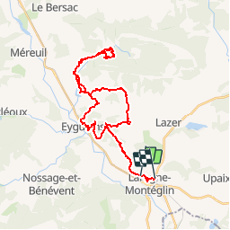
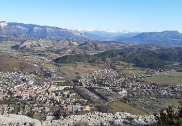
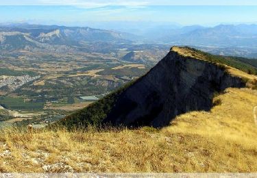
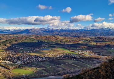
Trail Mountain bike of 35 km to be discovered at Provence-Alpes-Côte d'Azur, Hautes-Alpes, Laragne-Montéglin. This trail is proposed by tracegps.

Description

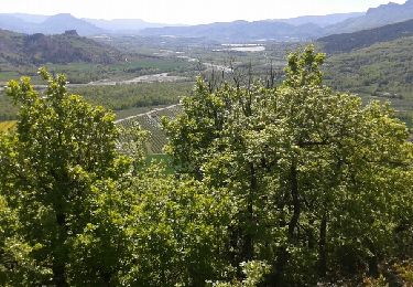
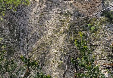
Très jolie balade dans le pays du Buech avec une descente technique à souhait dans les gorges du Riou. Itinéraire proposé par Rando Buech à la sortie du 21 septembre 2008. Merci a eux

Elevation profile

Positioning

Country:
France
Region :
Provence-Alpes-Côte d'Azur
Department/Province :
Hautes-Alpes
Municipality :
Laragne-Montéglin
Location:
Unknown
Start:(UTM)
724502 ; 4911223 (31T) N.

Comments

Please log in to post a review or rate the element


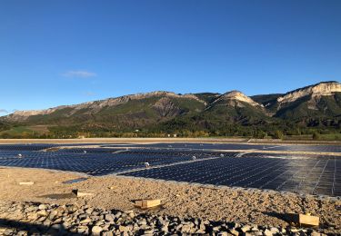
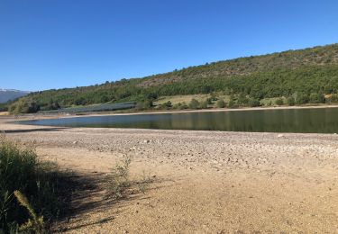
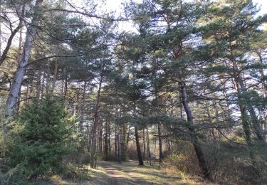
super ballade, paysages variés, baignade plan eau du riou....parfait.merci.


Trails nearby

Trail Walking Val-Buëch-Méouge - SityTrail - PF-Antonaves - Les Gorges de la Méouge - Photo
Walking
raymondfn

Walking

Medium
(1)
Val-Buëch-Méouge, Provence-Alpes-Côte d'Azur, Hautes-Alpes, France
13.3 km | 21 km-effort
4h 22min
Yes
Trail Walking Lazer - Le lac de Lazer par La Chapelle StJean - Photo
Walking
babouille

Walking

Medium
Lazer, Provence-Alpes-Côte d'Azur, Hautes-Alpes, France
6.5 km | 7.4 km-effort
1h 40min
Yes
Trail sport Mison - Du lac de MISON à celui du Poet par les colombettes  - Photo
sport
babouille

sport

Very easy
Mison, Provence-Alpes-Côte d'Azur, Alpes-de-Haute-Provence, France
5.7 km | 6.8 km-effort
Unknown
Yes
Trail Walking Laragne-Montéglin - Vieil Arzellier/Vieil Eyguians.21/02/21. - Photo
Walking
Dervalmarc

Walking

Easy
Laragne-Montéglin, Provence-Alpes-Côte d'Azur, Hautes-Alpes, France
3.5 km | 4.7 km-effort
59min
No
Trail Walking Val-Buëch-Méouge - CHATEAU NEUF DE CHABRE 05 . Piloubeau , les cretes de Chabre o s - Photo
Walking
RobinMicheline

Walking

Difficult
Val-Buëch-Méouge, Provence-Alpes-Côte d'Azur, Hautes-Alpes, France
14.8 km | 24 km-effort
6h 11min
Yes
Trail Walking Val-Buëch-Méouge - R31   La Montagne de Chabre - Photo
Walking
GUIDE+

Walking

Very easy
(1)
Val-Buëch-Méouge, Provence-Alpes-Côte d'Azur, Hautes-Alpes, France
2.8 km | 4.6 km-effort
1h 10min
Yes
Trail Walking Val-Buëch-Méouge - roche de baume rousse - Photo
Walking
margotte

Walking

Medium
Val-Buëch-Méouge, Provence-Alpes-Côte d'Azur, Hautes-Alpes, France
9.3 km | 14.1 km-effort
3h 37min
Yes
Trail Walking Val-Buëch-Méouge - Crête de Chabre - Photo
Walking
PapouBertrand

Walking

Very difficult
Val-Buëch-Méouge, Provence-Alpes-Côte d'Azur, Hautes-Alpes, France
14.5 km | 23 km-effort
4h 31min
Yes
Trail Walking Val-Buëch-Méouge - 190423 Tour des gorges de la Méouge  - Photo
Walking
mzonzon05

Walking

Very difficult
Val-Buëch-Méouge, Provence-Alpes-Côte d'Azur, Hautes-Alpes, France
31 km | 39 km-effort
5h 47min
No


Close
My subscriptions