Trail Walking Puy-Saint-Eusèbe - hameaux abandonnés Puy Saint Eusèbe - Photo

hameaux abandonnés Puy Saint Eusèbe

 gildascb
gildascb

User

© OpenStreetMap contributors
Length
Length
6.5 km
Max alt
Max alt
1660 m
Uphill gradient
Uphill gradient
317 m
Km-Effort
Km-Effort  
10.8 km
Min alt
Min alt
1461 m
Downhill gradient
Downhill gradient
322 m
Boucle
Boucle
Yes
Creation date :
2019-01-15 15:10:05.266
Updated on :
2021-08-12 16:14:41.097

(0 Reviews)

Walking
Walking
2h28
Difficulty : Very easy

Scan this QR Code to open this trail in the SityTrail application

FREE GPS app for hiking

Logo SityTrail SityTrail

IGN / Geographical institutes

Download SityTrail from the App Store Download SityTrail from Google Play

Logo SityTrail SityTrail World

The world is yours!

Download SityTrail from the App Store Download SityTrail from Google Play Download SityTrail on Huawei AppGallery

About

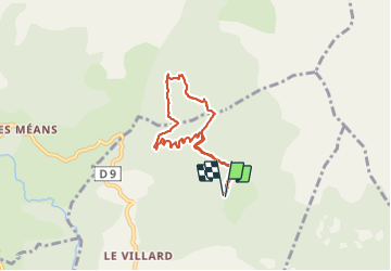
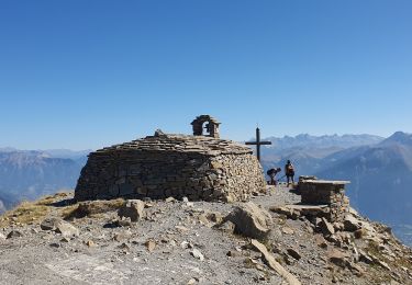
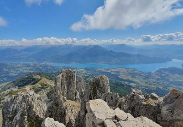
Trail Walking of 6.5 km to be discovered at Provence-Alpes-Côte d'Azur, Hautes-Alpes, Puy-Saint-Eusèbe. This trail is proposed by gildascb.

Description

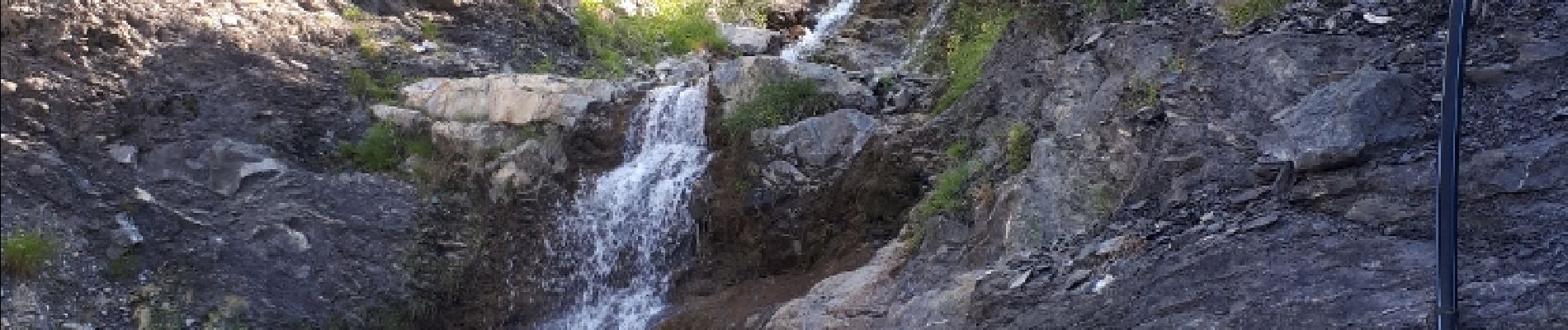
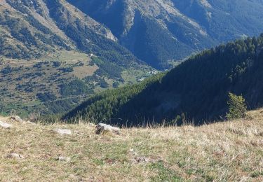
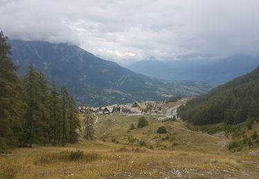
Promenade familiale très variée avec de beaux points de vue sur le lac de Serre-Ponçon. Cascades, jolie forêt avec de belles clairières, canal que l'on longe et 2 petits hameaux abandonnés.

Pour se rendre au départ : Aller à Puy-Saint-Eusèbe. Vous quittez la D9 pour se rendre au hameau l'Église. En montant, avant d'atteindre le hameau, vous prenez sur votre droite une route forestière indiquant Embrun par le belvédère de la Para. Vous suivez ce chemin qui monte sur 3,2km jusqu'au panneau Chemin de la Beaume. Chemin carrossable mais éviter les voitures trop basses.

Elevation profile

Photos

Points of interest

Point of interest Réallon - Point 3 - Photo
gildascb
RÉALLON 
Point of interest Réallon - Point 4 - Photo
gildascb
RÉALLON 
Point of interest Réallon - Point 5 - Photo
gildascb
RÉALLON 
Point of interest Réallon - Point 6 - Photo
gildascb
RÉALLON 
Point of interest Réallon - Point 7 - Photo
gildascb
RÉALLON 
Point of interest Réallon - Point 8 - Photo
gildascb
RÉALLON 
Point of interest Réallon - Point 9 - Photo
gildascb
RÉALLON 
Point of interest Puy-Saint-Eusèbe - Point 10 - Photo
gildascb
PUY-SAINT-EUSÈBE 
Point of interest Puy-Saint-Eusèbe - Point 11 - Photo
gildascb
PUY-SAINT-EUSÈBE 

Positioning

Country:
France
Region :
Provence-Alpes-Côte d'Azur
Department/Province :
Hautes-Alpes
Municipality :
Puy-Saint-Eusèbe
Location:
Unknown
Start:(UTM)
294845 ; 4939252 (32T) N.

Trails nearby

Trail Walking Réallon - AIguilles de Chabrieres au départ de la Station de ski Reallon - Photo
Walking
Maca8284

Walking

Very difficult
(1)
Réallon, Provence-Alpes-Côte d'Azur, Hautes-Alpes, France
14 km | 25 km-effort
6h 0min
Yes
Trail Walking Réallon - Aiguilles de Chabrière - Photo
Walking
GUIDE
David25400

Walking

Easy
(1)
Réallon, Provence-Alpes-Côte d'Azur, Hautes-Alpes, France
12.2 km | 23 km-effort
5h 35min
Yes
Trail Walking Embrun - Lac de l'Hivernet - Photo
Walking
gildascb

Walking

Easy
(1)
Embrun, Provence-Alpes-Côte d'Azur, Hautes-Alpes, France
10.6 km | 21 km-effort
3h 55min
Yes
Trail Walking Réallon - le fort de Réallon - Photo
Walking
gildascb

Walking

Very easy
(1)
Réallon, Provence-Alpes-Côte d'Azur, Hautes-Alpes, France
8 km | 11.8 km-effort
2h 11min
Yes
Trail Walking Embrun - Mont Guillaume-Col de Chanté Perdrix-Lac de l'Hivernet(07-09-16) - Photo
Walking
Dervalmarc

Walking

Difficult
(2)
Embrun, Provence-Alpes-Côte d'Azur, Hautes-Alpes, France
15.4 km | 31 km-effort
7h 4min
Yes
Trail Walking Embrun - Mont Guillaume - Col de Trempa-Latz - 2671 - 10/09/23 - Photo
Walking
GUIDE
R@ph

Walking

Very difficult
Embrun, Provence-Alpes-Côte d'Azur, Hautes-Alpes, France
13.6 km | 28 km-effort
6h 20min
Yes
Trail Walking Réallon - SityTrail - 2556786 - aiguilles-de-chabriere - Photo
Walking
GUIDE
amiral13

Walking

Difficult
Réallon, Provence-Alpes-Côte d'Azur, Hautes-Alpes, France
11.8 km | 23 km-effort
6h 0min
Yes
Trail Snowshoes Réallon - Raquettes Réallon  - Photo
Snowshoes
GUIDE
David25400

Snowshoes

Easy
Réallon, Provence-Alpes-Côte d'Azur, Hautes-Alpes, France
6.5 km | 14.3 km-effort
3h 27min
Yes
Trail Walking Réallon - Reallon-Serre du Mouton 7km - Photo
Walking
GUIDE
thonyc

Walking

Easy
Réallon, Provence-Alpes-Côte d'Azur, Hautes-Alpes, France
7.3 km | 13 km-effort
2h 53min
Yes


Close
My subscriptions