Trail Walking Embrun - Mont Guillaume-Col de Chanté Perdrix-Lac de l'Hivernet(07-09-16) - Photo

Mont Guillaume-Col de Chanté Perdrix-Lac de l'Hivernet(07-09-16)

© OpenStreetMap contributors
Length
Length
15.4 km
Max alt
Max alt
2625 m
Uphill gradient
Uphill gradient
1149 m
Km-Effort
Km-Effort  
31 km
Min alt
Min alt
1597 m
Downhill gradient
Downhill gradient
1142 m
Boucle
Boucle
Yes
Creation date :
2016-07-07 00:00:00.0
Updated on :
2016-07-07 00:00:00.0

(2 Reviews)

Walking
Walking
7h04
Difficulty : Difficult

Scan this QR Code to open this trail in the SityTrail application

FREE GPS app for hiking

Logo SityTrail SityTrail

IGN / Geographical institutes

Download SityTrail from the App Store Download SityTrail from Google Play

Logo SityTrail SityTrail World

The world is yours!

Download SityTrail from the App Store Download SityTrail from Google Play Download SityTrail on Huawei AppGallery

About

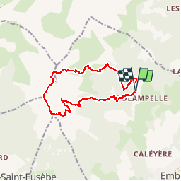
Trail Walking of 15.4 km to be discovered at Provence-Alpes-Côte d'Azur, Hautes-Alpes, Embrun. This trail is proposed by Dervalmarc.

Description

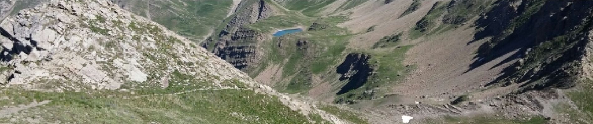
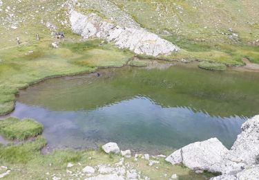
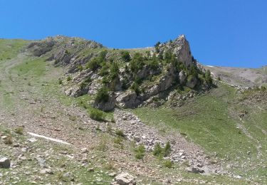
Randonnée très varié.Relativement facile jusqu'au col de Trempa Latz.Très difficile et pentu entre les deux cols, mauvais pierrier a la montée comme à la descente sur le Lac de l 'Hivernet la plus grande prudence est requise.

Elevation profile

Photos

Positioning

Country:
France
Region :
Provence-Alpes-Côte d'Azur
Department/Province :
Hautes-Alpes
Municipality :
Embrun
Location:
Unknown
Start:(UTM)
299622 ; 4940912 (32T) N.

Comments

Please log in to post a review or rate the element


le viens de faire à l'envers, cette rando en sens inverse en partant du Lac, je suis ok avec les remarques, que je n'avais pas lues avant, juste un mot pour signaler qu'il y a de nombreux cairns et qu'il faut bien les repérer, ils aident vraiment, de plus la moitié du temps on est sur de vagues sentes. Les deux parties délicates sont juste après Tempra-Latz et au début de la descente sous le sommet jusqu'au col, par moment il vaux peut-être mieux être un peu en contrebas de l'arrête côté sud, Je ne suis pas monté au mont Guillaume Chocar-Contemplatif


Trails nearby

Trail Walking Embrun - Lac de l'Hivernet - Photo
Walking
gildascb

Walking

Easy
(1)
Embrun, Provence-Alpes-Côte d'Azur, Hautes-Alpes, France
10.6 km | 21 km-effort
3h 55min
Yes
Trail Walking Châteauroux-les-Alpes - boucle cascade de la pisse - Photo
Walking
gildascb

Walking

Very easy
(1)
Châteauroux-les-Alpes, Provence-Alpes-Côte d'Azur, Hautes-Alpes, France
8.8 km | 12.4 km-effort
2h 17min
Yes
Trail Walking Embrun - Mont Guillaume - Col de Trempa-Latz - 2671 - 10/09/23 - Photo
Walking
GUIDE
R@ph

Walking

Very difficult
Embrun, Provence-Alpes-Côte d'Azur, Hautes-Alpes, France
13.6 km | 28 km-effort
6h 20min
Yes
Trail Walking Embrun - Mt Guillaume - Lac de l'Hivernet - Photo
Walking
GUIDE
David25400

Walking

Difficult
Embrun, Provence-Alpes-Côte d'Azur, Hautes-Alpes, France
12.7 km | 28 km-effort
4h 8min
Yes
Trail Walking Embrun - lac de l hivernet - Photo
Walking
gibello

Walking

Easy
(1)
Embrun, Provence-Alpes-Côte d'Azur, Hautes-Alpes, France
9.4 km | 19.5 km-effort
4h 1min
Yes
Trail Walking Embrun - Mont Guillaume - Photo
Walking
Marco05

Walking

Difficult
Embrun, Provence-Alpes-Côte d'Azur, Hautes-Alpes, France
12.6 km | 26 km-effort
5h 55min
Yes
Trail Walking Saint-André-d'Embrun - pinée et vietnam 221021 - Photo
Walking
GUIDE
David25400

Walking

Very easy
Saint-André-d'Embrun, Provence-Alpes-Côte d'Azur, Hautes-Alpes, France
39 km | 50 km-effort
4h 23min
No
Trail Walking Embrun - Muandes de Bourlinche 201021 - Photo
Walking
GUIDE
David25400

Walking

Very easy
Embrun, Provence-Alpes-Côte d'Azur, Hautes-Alpes, France
11.5 km | 21 km-effort
4h 3min
Yes
Trail Walking Châteauroux-les-Alpes - la cascade de la Pisse  - Photo
Walking
GILOU440

Walking

Medium
Châteauroux-les-Alpes, Provence-Alpes-Côte d'Azur, Hautes-Alpes, France
11.1 km | 15.9 km-effort
4h 26min
Yes


Close
My subscriptions