Trail Walking Brunémont - Brunémont entre étangs et canaux - Photo

Brunémont entre étangs et canaux

 terminio
terminio

User

© OpenStreetMap contributors
Length
Length
6.9 km
Max alt
Max alt
45 m
Uphill gradient
Uphill gradient
37 m
Km-Effort
Km-Effort  
7.4 km
Min alt
Min alt
34 m
Downhill gradient
Downhill gradient
37 m
Boucle
Boucle
Yes
Creation date :
2019-01-15 15:11:07.845
Updated on :
2019-01-15 15:11:07.845

(0 Reviews)

Walking
Walking
1h37
Difficulty : Easy

Scan this QR Code to open this trail in the SityTrail application

FREE GPS app for hiking

Logo SityTrail SityTrail

IGN / Geographical institutes

Download SityTrail from the App Store Download SityTrail from Google Play

Logo SityTrail SityTrail World

The world is yours!

Download SityTrail from the App Store Download SityTrail from Google Play Download SityTrail on Huawei AppGallery

About

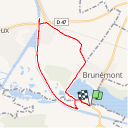
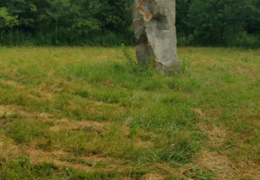
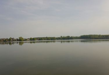
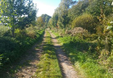
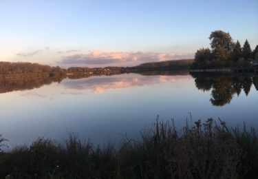
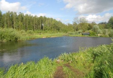
Trail Walking of 6.9 km to be discovered at Hauts-de-France, Nord, Brunémont. This trail is proposed by terminio.

Description

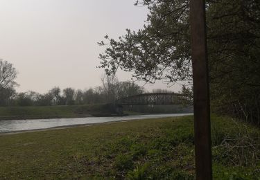
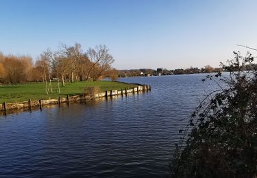
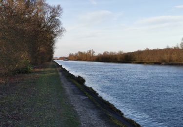
Au départ de Brunemont, découverte des étangs,traversée de la campagne avec route pavée et retour le long de la berge du canal de la sensée.

Elevation profile

Photos

Positioning

Country:
France
Region :
Hauts-de-France
Department/Province :
Nord
Municipality :
Brunémont
Location:
Unknown
Start:(UTM)
509779 ; 5568100 (31U) N.

Trails nearby

Trail On foot Écourt-Saint-Quentin - SityTrail - autour du marais - Photo
On foot
Morelli

On foot

Difficult
(1)
Écourt-Saint-Quentin, Hauts-de-France, Pas-de-Calais, France
22 km | 25 km-effort
Unknown
Yes
Trail Walking Oisy-le-Verger - entre Oisy Ecourt et Palluel - Photo
Walking
Celtie

Walking

Medium
Oisy-le-Verger, Hauts-de-France, Pas-de-Calais, France
5 km | 5.4 km-effort
1h 9min
Yes
Trail Walking Oisy-le-Verger - Oisy Le Verger Palluel - Photo
Walking
terminio

Walking

Very easy
Oisy-le-Verger, Hauts-de-France, Pas-de-Calais, France
7.6 km | 8.2 km-effort
2h 15min
Yes
Trail Walking Oisy-le-Verger -  Oisy Le Verger et Palluel - Photo
Walking
terminio

Walking

Very easy
Oisy-le-Verger, Hauts-de-France, Pas-de-Calais, France
5.1 km | 5.5 km-effort
1h 26min
Yes
Trail Walking Écourt-Saint-Quentin - autour du marais - Photo
Walking
phil331

Walking

Easy
Écourt-Saint-Quentin, Hauts-de-France, Pas-de-Calais, France
16.4 km | 0 m-effort
3h 19min
No
Trail Walking Palluel - Étangs de Palluel et Arleux  - Photo
Walking
terminio

Walking

Very easy
Palluel, Hauts-de-France, Pas-de-Calais, France
7.7 km | 8.2 km-effort
2h 12min
Yes
Trail Walking Oisy-le-Verger -  Autour des étangs et du bois de Oisy le Verger - Photo
Walking
terminio

Walking

Very easy
Oisy-le-Verger, Hauts-de-France, Pas-de-Calais, France
4.6 km | 5.3 km-effort
1h 25min
Yes
Trail Walking Aubigny-au-Bac - Circuit autour des marais de la Sensée. - Photo
Walking
dautriche

Walking

Easy
Aubigny-au-Bac, Hauts-de-France, Nord, France
27 km | 29 km-effort
6h 29min
No
Trail Walking Palluel - Les marais autour de Palluel  - Photo
Walking
tracegps

Walking

Medium
(1)
Palluel, Hauts-de-France, Pas-de-Calais, France
13.7 km | 14.6 km-effort
3h 30min
Yes


Close
My subscriptions