


BONNEVAL SUR ARC (73)

AndreLACOMBE
User
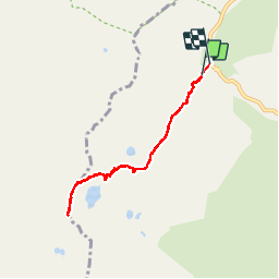

Length
6.8 km

Max alt
3046 m

Uphill gradient
474 m
Km-Effort
13.2 km

Min alt
2531 m

Downhill gradient
508 m
Boucle
Yes
Creation date :
2019-01-15 15:21:57.202
Updated on :
2019-01-15 15:21:57.202
5h27
Difficulty : Medium

FREE GPS app for hiking
 SityTrail
IGN / Geographical institutes
SityTrail Plus
The world is yours!
About
Trail Walking of 6.8 km to be discovered at Auvergne-Rhône-Alpes, Savoy, Bonneval-sur-Arc. This trail is proposed by AndreLACOMBE.
Description
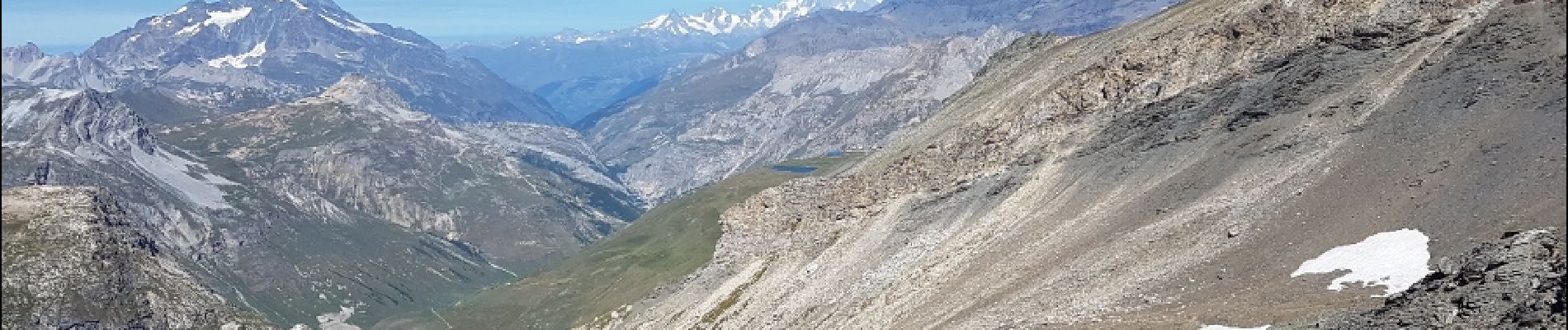
Depuis le Pont de la Neige (2528 m), montée au lac du Grand Fond (2899 m), puis col des Fours (2976 m) et pointe des Fours (3072 m). Retour par le même itinéraire.
Photos
 - Photo 1")
 - Photo 2")
 - Photo 3")
 - Photo 4")
 - Photo 5")
 - Photo 6")
 - Photo 7")
Positioning
Country:
France
Region :
Auvergne-Rhône-Alpes
Department/Province :
Savoy
Municipality :
Bonneval-sur-Arc
Location:
Unknown
Start:(Dec)
Start:(UTM)
345539 ; 5029881 (32T) N.
Comments