Trail Walking Teyssières - Autour de Teysseires dans le Pays de Dieulefit - Photo

Autour de Teysseires dans le Pays de Dieulefit

 tracegps
tracegps

User

© OpenStreetMap contributors
Length
Length
12.3 km
Max alt
Max alt
861 m
Uphill gradient
Uphill gradient
602 m
Km-Effort
Km-Effort  
20 km
Min alt
Min alt
434 m
Downhill gradient
Downhill gradient
600 m
Boucle
Boucle
Yes
Creation date :
2014-12-10 00:00:00.0
Updated on :
2014-12-10 00:00:00.0

(0 Reviews)

Walking
Walking
4h00
Difficulty : Medium

Scan this QR Code to open this trail in the SityTrail application

FREE GPS app for hiking

Logo SityTrail SityTrail

IGN / Geographical institutes

Download SityTrail from the App Store Download SityTrail from Google Play

Logo SityTrail SityTrail World

The world is yours!

Download SityTrail from the App Store Download SityTrail from Google Play Download SityTrail on Huawei AppGallery

About

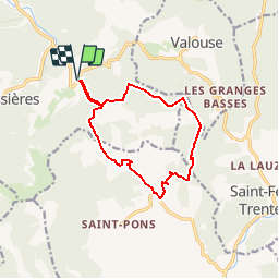
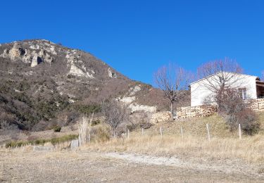
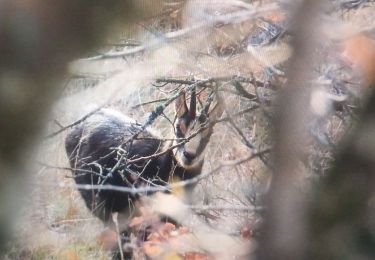
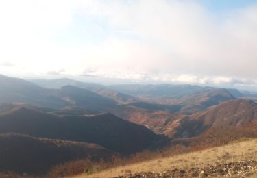
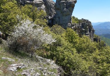
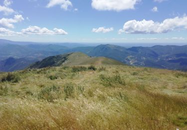
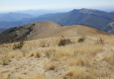
Trail Walking of 12.3 km to be discovered at Auvergne-Rhône-Alpes, Drôme, Teyssières. This trail is proposed by tracegps.

Description

C'est une rando casse-croûte entre la Montagne d'Autuche et Le Cougoir Plus de détails au gîte du Pré bossu.

Elevation profile

Photos

Positioning

Country:
France
Region :
Auvergne-Rhône-Alpes
Department/Province :
Drôme
Municipality :
Teyssières
Location:
Unknown
Start:(Dec)
Start:(UTM)
671472 ; 4924538 (31T) N.

Trails nearby

Trail Walking Teyssières - Randonnée au départ de Teyssières (Le Cougoir, La Lance) - Photo
Walking
Julie LABBE

Walking

Very difficult
Teyssières, Auvergne-Rhône-Alpes, Drôme, France
22 km | 40 km-effort
9h 2min
Yes
Trail Walking Vesc - bec de jus - Photo
Walking
parastat

Walking

Medium
Vesc, Auvergne-Rhône-Alpes, Drôme, France
5.1 km | 10.9 km-effort
2h 27min
Yes
Trail Walking Valouse - mielandre  - Photo
Walking
andrechauvin

Walking

Very difficult
Valouse, Auvergne-Rhône-Alpes, Drôme, France
11.3 km | 23 km-effort
6h 34min
Yes
Trail Walking Valouse - 2021_11_14  - Photo
Walking
Atchoum26

Walking

Easy
Valouse, Auvergne-Rhône-Alpes, Drôme, France
10.5 km | 22 km-effort
3h 33min
Yes
Trail Walking Valouse - 2021_11_14 Miélandre - Photo
Walking
Atchoum26

Walking

Very difficult
Valouse, Auvergne-Rhône-Alpes, Drôme, France
10.5 km | 22 km-effort
3h 50min
Yes
Trail Walking Montjoux - Grottes Sarrazines - Photo
Walking
ajd26

Walking

Easy
Montjoux, Auvergne-Rhône-Alpes, Drôme, France
16.2 km | 25 km-effort
5h 5min
Yes
Trail Walking Valouse - mielandre par valouse départ basse grange  - Photo
Walking
Joel26400

Walking

Medium
Valouse, Auvergne-Rhône-Alpes, Drôme, France
14.2 km | 28 km-effort
4h 51min
Yes
Trail Walking Vesc - Mielandre par col d'Espreaux 7km - Photo
Walking
GUIDE
thonyc

Walking

Difficult
Vesc, Auvergne-Rhône-Alpes, Drôme, France
7.1 km | 15.7 km-effort
5h 3min
Yes
Trail Walking Valouse - 2019-09-29 16:27:25 - Photo
Walking
GUIDE
thonyc

Walking

Difficult
Valouse, Auvergne-Rhône-Alpes, Drôme, France
11.3 km | 22 km-effort
4h 25min
Yes


Close
My subscriptions