Trail Mountain bike Verdalle - Entre Plaine et Montagne - Photo

Entre Plaine et Montagne

 tracegps
tracegps

User

© OpenStreetMap contributors
Length
Length
37 km
Max alt
Max alt
819 m
Uphill gradient
Uphill gradient
856 m
Km-Effort
Km-Effort  
48 km
Min alt
Min alt
209 m
Downhill gradient
Downhill gradient
856 m
Boucle
Boucle
Yes
Creation date :
2014-12-10 00:00:00.0
Updated on :
2014-12-10 00:00:00.0

(0 Reviews)

Mountain bike
Mountain bike
3h00
Difficulty : Difficult

Scan this QR Code to open this trail in the SityTrail application

FREE GPS app for hiking

Logo SityTrail SityTrail

IGN / Geographical institutes

Download SityTrail from the App Store Download SityTrail from Google Play

Logo SityTrail SityTrail World

The world is yours!

Download SityTrail from the App Store Download SityTrail from Google Play Download SityTrail on Huawei AppGallery

About

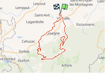
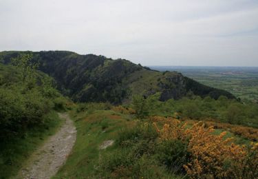
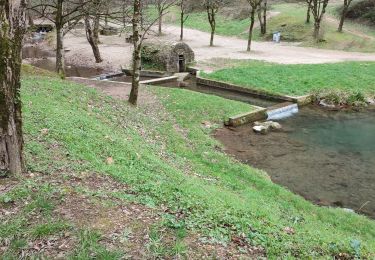
Trail Mountain bike of 37 km to be discovered at Occitania, Tarn, Verdalle. This trail is proposed by tracegps.

Description

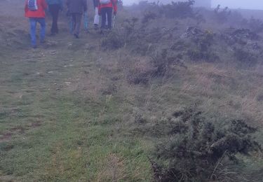
Circuit au départ de l'église Saint jean de Verdalle. Le premier tiers du circuit permet de découvrir la plaine avant d'attaquer l'ascension de la montagne jusqu'à la table d'orientation de Montalric. Retour par Massaguel via la Capelette (désert de Saint Ferreol). Coté technique, le circuit est facile car il n'emprunte que des pistes assez roulantes. Il est difficile par son dénivelé. Pour les amateurs de Geocaching visitez les caches: GC16ZYV By-Pass GCZE8J Le désert de Saint Ferreol GC103EH Montalric

Elevation profile

Photos

Positioning

Country:
France
Region :
Occitania
Department/Province :
Tarn
Municipality :
Verdalle
Location:
Unknown
Start:(UTM)
431717 ; 4818888 (31T) N.

Trails nearby

Trail Walking Dourgne - Désert de St Férréol - Photo
Walking
tracegps

Walking

Medium
(1)
Dourgne, Occitania, Tarn, France
7.6 km | 12.1 km-effort
3h 45min
Yes
Trail Electric bike Dourgne - Capelette table orientation  - Photo
Electric bike
NICOLAS VEITH

Electric bike

(1)
Dourgne, Occitania, Tarn, France
21 km | 30 km-effort
1h 59min
No
Trail Walking Dourgne - rando dourgne - Photo
Walking
Mamilaure

Walking

Medium
Dourgne, Occitania, Tarn, France
13 km | 18.5 km-effort
3h 32min
Yes
Trail Walking Dourgne - Dourgne - Revel - Photo
Walking
RR31

Walking

Medium
Dourgne, Occitania, Tarn, France
22 km | 25 km-effort
2h 39min
No
Trail Walking Dourgne - Le désert de St Férréol - Photo
Walking
tracegps

Walking

Medium
Dourgne, Occitania, Tarn, France
7.6 km | 12.1 km-effort
3h 45min
Yes
Trail Mountain bike Verdalle - Taurou-Sant - Photo
Mountain bike
tracegps

Mountain bike

Difficult
Verdalle, Occitania, Tarn, France
38 km | 50 km-effort
3h 30min
Yes
Trail Mountain bike Dourgne - Dourgne, Montagne noire - Photo
Mountain bike
tracegps

Mountain bike

Very difficult
Dourgne, Occitania, Tarn, France
34 km | 49 km-effort
4h 30min
No
Trail Walking Dourgne - De Ste Scholastique à chapelle St Ferréol la Capelette - Photo
Walking
geli.henri

Walking

Easy
Dourgne, Occitania, Tarn, France
6.5 km | 10.4 km-effort
2h 13min
Yes
Trail Walking Dourgne - De Sainte Scholastique  vers les 4 sainte - Dourgne - Photo
Walking
tercla

Walking

Difficult
Dourgne, Occitania, Tarn, France
17.3 km | 25 km-effort
6h 27min
Yes


Close
My subscriptions