


Cerces

Sugg
User
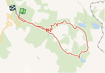

Length
11.3 km

Max alt
2583 m

Uphill gradient
593 m
Km-Effort
19.3 km

Min alt
1967 m

Downhill gradient
613 m
Boucle
Yes
Creation date :
2019-03-22 16:57:45.571
Updated on :
2019-03-22 16:57:45.636
4h40
Difficulty : Unknown

FREE GPS app for hiking
 SityTrail
IGN / Geographical institutes
SityTrail Plus
The world is yours!
About
Trail Walking of 11.3 km to be discovered at Auvergne-Rhône-Alpes, Savoy, Valloire. This trail is proposed by Sugg.
Positioning
Country:
France
Region :
Auvergne-Rhône-Alpes
Department/Province :
Savoy
Municipality :
Valloire
Location:
Unknown
Start:(Dec)
Start:(UTM)
298286 ; 4996025 (32T) N.
Comments