Trail Mountain bike Dole - Petit tour dans la Serre - Photo

Petit tour dans la Serre

 tracegps
tracegps

User

© OpenStreetMap contributors
Length
Length
36 km
Max alt
Max alt
374 m
Uphill gradient
Uphill gradient
720 m
Km-Effort
Km-Effort  
45 km
Min alt
Min alt
225 m
Downhill gradient
Downhill gradient
719 m
Boucle
Boucle
Yes
Creation date :
2014-12-10 00:00:00.0
Updated on :
2014-12-10 00:00:00.0

(0 Reviews)

Mountain bike
Mountain bike
3h15
Difficulty : Difficult

Scan this QR Code to open this trail in the SityTrail application

FREE GPS app for hiking

Logo SityTrail SityTrail

IGN / Geographical institutes

Download SityTrail from the App Store Download SityTrail from Google Play

Logo SityTrail SityTrail World

The world is yours!

Download SityTrail from the App Store Download SityTrail from Google Play Download SityTrail on Huawei AppGallery

About

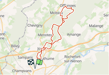
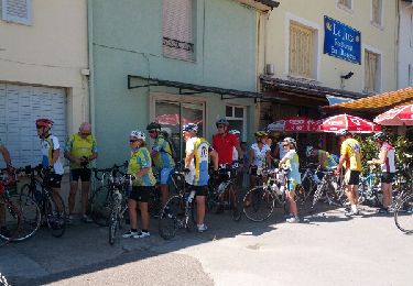
Trail Mountain bike of 36 km to be discovered at Bourgogne-Franche-Comté, Jura, Dole. This trail is proposed by tracegps.

Description

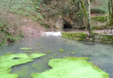
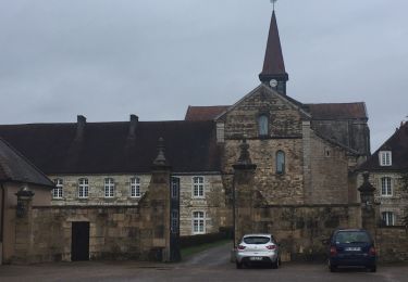
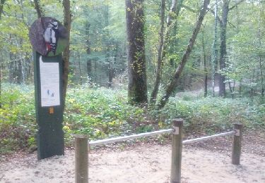
Parcours vtt, départ de Dole, passage par le mont Roland, puis le massif de la Serre. Circuit principalement dans la forêt. Le retour par Offlanges (Joli point de vue), est très roulant.

Elevation profile

Points of interest

Point of interest Moissey - Grotte de L hermitage - Photo
tracegps
Point of interest Offlanges - Offlanges - Photo
tracegps
OFFLANGES 

Positioning

Country:
France
Region :
Bourgogne-Franche-Comté
Department/Province :
Jura
Municipality :
Dole
Location:
Unknown
Start:(UTM)
687908 ; 5220265 (31T) N.

Trails nearby

Trail Walking Jouhe - Mont Roland 11.7km 20161215 - Photo
Walking
cmike39

Walking

Very easy
(1)
Jouhe, Bourgogne-Franche-Comté, Jura, France
11.8 km | 15.4 km-effort
3h 18min
Yes
Trail Walking Dole - Dole ville - Photo
Walking
FOUCAULT

Walking

Dole, Bourgogne-Franche-Comté, Jura, France
9.1 km | 10.6 km-effort
3h 2min
Yes
Trail Walking Dole - Via Cluny: de Dole (Jura) à Cluny - Photo
Walking
GUIDE
ViaCluny

Walking

Very difficult
Dole, Bourgogne-Franche-Comté, Jura, France
360 km | 478 km-effort
108h 38min
No
Trail Road bike Dole - mn05 - Photo
Road bike
berhin

Road bike

Very difficult
Dole, Bourgogne-Franche-Comté, Jura, France
58 km | 63 km-effort
7h 44min
No
Trail Walking Archelange - Archelange Mont Roland 2021-02-02 CAF - Photo
Walking
TRIMAILLE

Walking

Medium
Archelange, Bourgogne-Franche-Comté, Jura, France
22 km | 28 km-effort
4h 23min
Yes
Trail Walking Dole - muguet confinement - Photo
Walking
phileasy

Walking

Easy
Dole, Bourgogne-Franche-Comté, Jura, France
8 km | 9 km-effort
2h 16min
Yes
Trail Walking Jouhe - g)Etapa 7 - Photo
Walking
RafaTuareg

Walking

Easy
Jouhe, Bourgogne-Franche-Comté, Jura, France
26 km | 31 km-effort
2h 4min
No
Trail Walking Dole - Sentier des chênes rouges - Photo
Walking
albert39

Walking

Easy
Dole, Bourgogne-Franche-Comté, Jura, France
11.6 km | 13.7 km-effort
3h 47min
Yes
Trail Cycle Dole - Bletterans - Photo
Cycle
albert39

Cycle

Difficult
Dole, Bourgogne-Franche-Comté, Jura, France
125 km | 138 km-effort
6h 11min
Yes


Close
My subscriptions