Trail Walking Misérieux - 14eme Misellane ou comment user ses semelles - Photo

14eme Misellane ou comment user ses semelles

 tracegps
tracegps

User

© OpenStreetMap contributors
Length
Length
16.5 km
Max alt
Max alt
279 m
Uphill gradient
Uphill gradient
209 m
Km-Effort
Km-Effort  
19.2 km
Min alt
Min alt
226 m
Downhill gradient
Downhill gradient
209 m
Boucle
Boucle
Yes
Creation date :
2014-12-10 00:00:00.0
Updated on :
2014-12-10 00:00:00.0

(0 Reviews)

Walking
Walking
3h00
Difficulty : Medium

Scan this QR Code to open this trail in the SityTrail application

FREE GPS app for hiking

Logo SityTrail SityTrail

IGN / Geographical institutes

Download SityTrail from the App Store Download SityTrail from Google Play

Logo SityTrail SityTrail World

The world is yours!

Download SityTrail from the App Store Download SityTrail from Google Play Download SityTrail on Huawei AppGallery

About

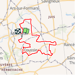
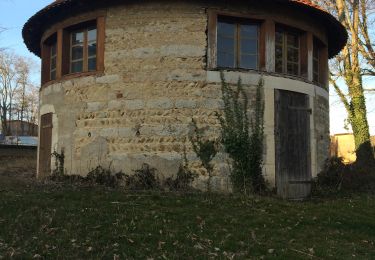
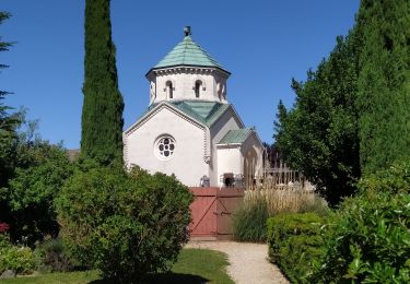
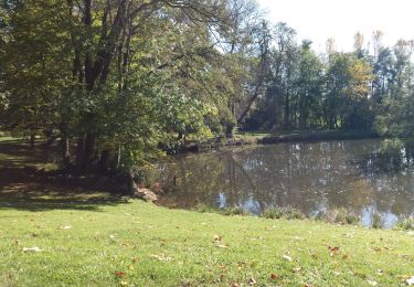
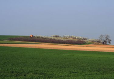
Trail Walking of 16.5 km to be discovered at Auvergne-Rhône-Alpes, Ain, Misérieux. This trail is proposed by tracegps.

Description

Rando au départ du terrain de foot de Miserieux. Tracé avec beaucoup de bitume et sans aucune difficulté sauf les grands plateaux de la Dombes ou l’on cuit au moindre rayon de soleil et l’on gèle si il fait froid, au moindre coup de vent, on a l’impression d’être dans une tempête.

Elevation profile

Photos

Positioning

Country:
France
Region :
Auvergne-Rhône-Alpes
Department/Province :
Ain
Municipality :
Misérieux
Location:
Unknown
Start:(UTM)
640588 ; 5092415 (31T) N.

Trails nearby

Trail Walking Savigneux - Savigneux le Fond de Juis Savigneux - Photo
Walking
jll7513

Walking

Very easy
Savigneux, Auvergne-Rhône-Alpes, Ain, France
12.7 km | 14 km-effort
3h 7min
Yes
Trail Walking Ars-sur-Formans - Ars-s-formans (Cibeins) - Photo
Walking
Thomasdanielle

Walking

Easy
Ars-sur-Formans, Auvergne-Rhône-Alpes, Ain, France
4.3 km | 5.3 km-effort
1h 14min
Yes
Trail Walking Ars-sur-Formans - Ars-Sur-Formans (13,5 km) - Photo
Walking
Thomasdanielle

Walking

Medium
Ars-sur-Formans, Auvergne-Rhône-Alpes, Ain, France
13.5 km | 15.7 km-effort
3h 25min
Yes
Trail Walking Trévoux - TREVOUX  -  01 - Photo
Walking
AndreLACOMBE

Walking

Very easy
Trévoux, Auvergne-Rhône-Alpes, Ain, France
11.7 km | 12.6 km-effort
3h 26min
Yes
Trail Walking Trévoux - ars - Photo
Walking
GALIBER

Walking

Difficult
Trévoux, Auvergne-Rhône-Alpes, Ain, France
12.6 km | 15 km-effort
4h 35min
No
Trail Walking Jassans-Riottier - de Jassans à Ars - Photo
Walking
maclobar

Walking

Very easy
Jassans-Riottier, Auvergne-Rhône-Alpes, Ain, France
19.5 km | 23 km-effort
6h 1min
Yes
Trail Walking Jassans-Riottier - Jassans-Beauregard-Fareins (15 km - D. 177 m) - Photo
Walking
Thomasdanielle

Walking

Easy
Jassans-Riottier, Auvergne-Rhône-Alpes, Ain, France
15 km | 17.4 km-effort
3h 55min
No
Trail Equestrian Trévoux - test - Photo
Equestrian
uvana

Equestrian

Very easy
Trévoux, Auvergne-Rhône-Alpes, Ain, France
28 km | 31 km-effort
1h 15min
No
Trail Walking Civrieux -  Le grand tour - Civrieux en Dombes - Photo
Walking
tracegps

Walking

Medium
(1)
Civrieux, Auvergne-Rhône-Alpes, Ain, France
7.2 km | 8 km-effort
2h 0min
Yes


Close
My subscriptions