Trail Mountain bike Langeais - Rando Gadoue - Langeais - Photo
 tracegps
tracegps

User

© OpenStreetMap contributors
Length
Length
47 km
Max alt
Max alt
113 m
Uphill gradient
Uphill gradient
529 m
Km-Effort
Km-Effort  
55 km
Min alt
Min alt
42 m
Downhill gradient
Downhill gradient
526 m
Boucle
Boucle
Yes
Creation date :
2014-12-10 00:00:00.0
Updated on :
2014-12-10 00:00:00.0

(0 Reviews)

Mountain bike
Mountain bike
4h00
Difficulty : Difficult

Scan this QR Code to open this trail in the SityTrail application

FREE GPS app for hiking

Logo SityTrail SityTrail

IGN / Geographical institutes

Download SityTrail from the App Store Download SityTrail from Google Play

Logo SityTrail SityTrail World

The world is yours!

Download SityTrail from the App Store Download SityTrail from Google Play Download SityTrail on Huawei AppGallery

About

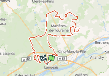
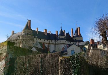
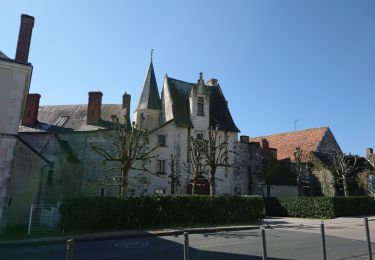
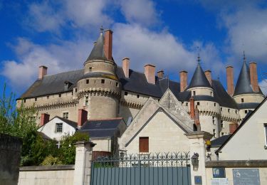
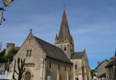
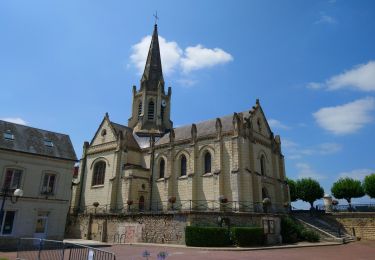
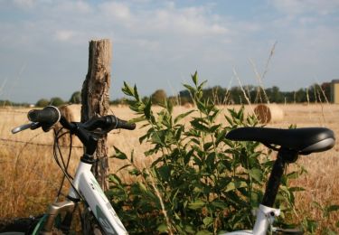
Trail Mountain bike of 47 km to be discovered at Centre-Loire Valley, Indre-et-Loire, Langeais. This trail is proposed by tracegps.

Description

Elle porte bien son nom...organisée par Les Sentiers Langeaisiens. Rando organisée généralement en novembre, quand il a bien plu. Assez difficile selon la saison car ça colle un pneu! Circuits sur les pentes de Langeais au milieu des châtaigniers. Jolis paysages.

Elevation profile

Positioning

Country:
France
Region :
Centre-Loire Valley
Department/Province :
Indre-et-Loire
Municipality :
Langeais
Location:
Langeais
Start:(UTM)
303434 ; 5244847 (31T) N.

Trails nearby

Trail Walking Lignières-de-Touraine - Lignière de Touraine-Le 26-09-2013- Distance 10,4 km - Auteur tintin37 - Photo
Walking
Martinjeanclaude

Walking

Medium
(2)
Lignières-de-Touraine, Centre-Loire Valley, Indre-et-Loire, France
10.4 km | 11.8 km-effort
2h 30min
Yes
Trail Walking Cinq-Mars-la-Pile - Cinq-Mars-la-Pile - Langeais - 14km 205m 3h05 - 2024 02 14 - Photo
Walking
Orcal37

Walking

Easy
Cinq-Mars-la-Pile, Centre-Loire Valley, Indre-et-Loire, France
14 km | 16.7 km-effort
3h 5min
Yes
Trail Walking Coteaux-sur-Loire - Saint-Michel-sur-Loire - GRP Coteaux de Bourgueil Saint-Patrice - 21.7km 240m 4h45 (35mn) - 2023 04 19 - Photo
Walking
Orcal37

Walking

Easy
Coteaux-sur-Loire, Centre-Loire Valley, Indre-et-Loire, France
22 km | 25 km-effort
4h 45min
Yes
Trail Walking Langeais - Langeais - PR Saint-Michel-sur-Loire - 20.8km 325m 5h10 (30mn) - 2023 04 15 - Photo
Walking
Orcal37

Walking

Medium
Langeais, Centre-Loire Valley, Indre-et-Loire, France
21 km | 25 km-effort
5h 10min
Yes
Trail Walking Cinq-Mars-la-Pile - Cinq-Mars-la-Pile - le Mortier Rougeau - 19.5km 265m 4h30 - 2022 04 17 - Photo
Walking
Orcal37

Walking

Easy
Cinq-Mars-la-Pile, Centre-Loire Valley, Indre-et-Loire, France
19.7 km | 23 km-effort
4h 30min
Yes
Trail Walking Lignières-de-Touraine - Lignières-de-Touraine - la Chapelle-aux-Naux - 24 km 4h45mn  - Photo
Walking
Orcal37

Walking

Medium
Lignières-de-Touraine, Centre-Loire Valley, Indre-et-Loire, France
24 km | 27 km-effort
4h 45min
Yes
Trail Walking Bréhémont - brehemont 2 - Photo
Walking
fustier

Walking

Very easy
Bréhémont, Centre-Loire Valley, Indre-et-Loire, France
22 km | 24 km-effort
5h 24min
Yes
Trail Walking Bréhémont - Brehemont - 3.9km 15m 50mn - 2018 02 18 - Photo
Walking
Orcal37

Walking

Very easy
Bréhémont, Centre-Loire Valley, Indre-et-Loire, France
3.9 km | 4.2 km-effort
50min
Yes
Trail Mountain bike Cinq-Mars-la-Pile - Cinq Mars la Pile, Maziéres de Touraine, Langeais - Photo
Mountain bike
tracegps

Mountain bike

Difficult
Cinq-Mars-la-Pile, Centre-Loire Valley, Indre-et-Loire, France
26 km | 31 km-effort
1h 45min
Yes


Close
My subscriptions