Trail Walking Le Mesnil-Ozenne - Le Mesnil Ozenne - Photo
 tracegps
tracegps

User

© OpenStreetMap contributors
Length
Length
4 km
Max alt
Max alt
179 m
Uphill gradient
Uphill gradient
96 m
Km-Effort
Km-Effort  
5.3 km
Min alt
Min alt
104 m
Downhill gradient
Downhill gradient
96 m
Boucle
Boucle
Yes
Creation date :
2014-12-10 00:00:00.0
Updated on :
2014-12-10 00:00:00.0

(0 Reviews)

Walking
Walking
45m
Difficulty : Medium

Scan this QR Code to open this trail in the SityTrail application

FREE GPS app for hiking

Logo SityTrail SityTrail

IGN / Geographical institutes

Download SityTrail from the App Store Download SityTrail from Google Play

Logo SityTrail SityTrail World

The world is yours!

Download SityTrail from the App Store Download SityTrail from Google Play Download SityTrail on Huawei AppGallery

About

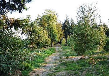
Trail Walking of 4 km to be discovered at Normandy, Manche, Le Mesnil-Ozenne. This trail is proposed by tracegps.

Description

Très belle randonnée pédestre alternant petites routes et sentiers en sous bois. Quelques dénivelés difficiles en hiver. Profiter du panorama au point de départ, belle vue sur le Bocage et sur le Mont St Michel. A visiter : la petite Chapelle de Notre Dame du Val. Location de GPS à l'Office de Tourisme de Ducey et sur www.label-nature.net

Elevation profile

Positioning

Country:
France
Region :
Normandy
Department/Province :
Manche
Municipality :
Le Mesnil-Ozenne
Location:
Unknown
Start:(UTM)
630838 ; 5392162 (30U) N.

Trails nearby

Trail Cycle Isigny-le-Buat - Véloscénie 4ème étape - Photo
Cycle
destras

Cycle

Easy
Isigny-le-Buat, Normandy, Manche, France
120 km | 131 km-effort
6h 50min
No
Trail Mountain bike Le Petit-Celland - Espace VTT FFC de la Vallée de la Sée - circuit n°17 - Tour de la Vallée de la Sée - Photo
Mountain bike
tracegps

Mountain bike

Very difficult
(1)
Le Petit-Celland, Normandy, Manche, France
160 km | 202 km-effort
16h 0min
Yes
Trail Running Le Mesnil-Ozenne - Le Mesnil Ozenne - Photo
Running
tracegps

Running

Difficult
Le Mesnil-Ozenne, Normandy, Manche, France
4 km | 5.3 km-effort
19min
Yes
Trail Mountain bike Le Mesnil-Ozenne - Le Mesnil Ozenne - Photo
Mountain bike
tracegps

Mountain bike

Easy
Le Mesnil-Ozenne, Normandy, Manche, France
4 km | 5.3 km-effort
15min
Yes
Trail Walking Isigny-le-Buat - Randonnée Mont Saint Michel 4 partie - Photo
Walking
renauddefroidmont

Walking

Medium
Isigny-le-Buat, Normandy, Manche, France
30 km | 33 km-effort
7h 31min
No
Trail 4x4 Le Petit-Celland - rando 24 nov 2019 - Photo
4x4
alex12r

4x4

Very easy
Le Petit-Celland, Normandy, Manche, France
55 km | 69 km-effort
3h 30min
No
Trail Walking Ducey-les-Chéris - DUCEY ---COURTILS - Photo
Walking
Bernardroland

Walking

Easy
Ducey-les-Chéris, Normandy, Manche, France
15 km | 16.1 km-effort
3h 51min
No


Close
My subscriptions