Trail Walking Barbirey-sur-Ouche - Le Tour de Barbiriacum - Barbirey sur Ouche - Photo

Le Tour de Barbiriacum - Barbirey sur Ouche

 tracegps
tracegps

User

© OpenStreetMap contributors
Length
Length
10.5 km
Max alt
Max alt
554 m
Uphill gradient
Uphill gradient
403 m
Km-Effort
Km-Effort  
15.9 km
Min alt
Min alt
301 m
Downhill gradient
Downhill gradient
409 m
Boucle
Boucle
Yes
Creation date :
2014-12-10 00:00:00.0
Updated on :
2014-12-10 00:00:00.0

(1 Reviews)

Walking
Walking
2h45
Difficulty : Medium

Scan this QR Code to open this trail in the SityTrail application

FREE GPS app for hiking

Logo SityTrail SityTrail

IGN / Geographical institutes

Download SityTrail from the App Store Download SityTrail from Google Play

Logo SityTrail SityTrail World

The world is yours!

Download SityTrail from the App Store Download SityTrail from Google Play Download SityTrail on Huawei AppGallery

About

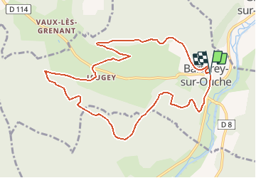
Trail Walking of 10.5 km to be discovered at Bourgogne-Franche-Comté, Côte-d'Or, Barbirey-sur-Ouche. This trail is proposed by tracegps.

Description

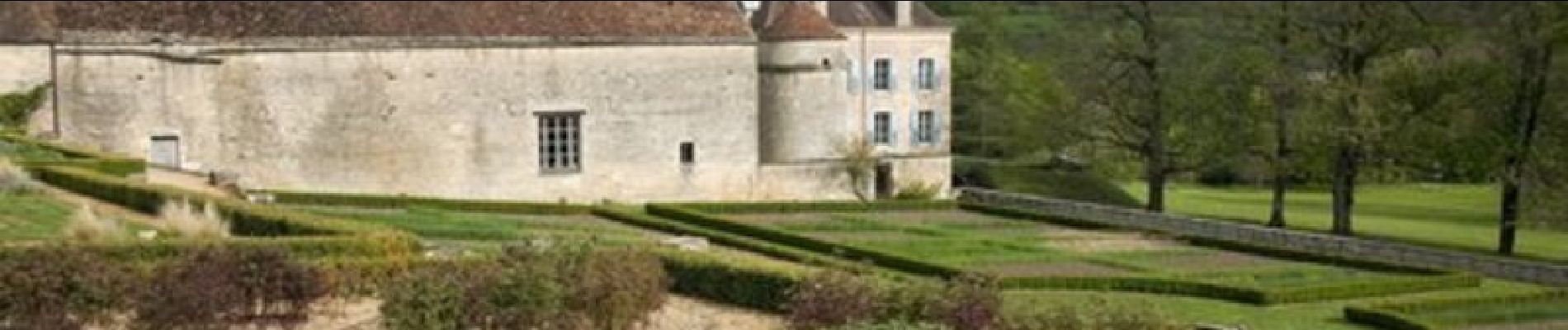
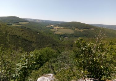
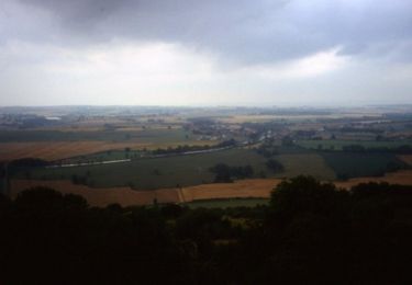
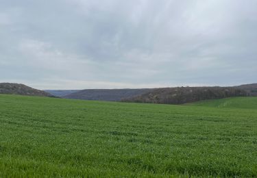
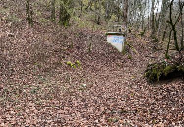
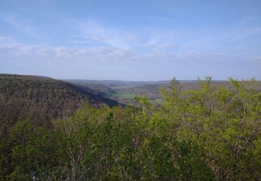
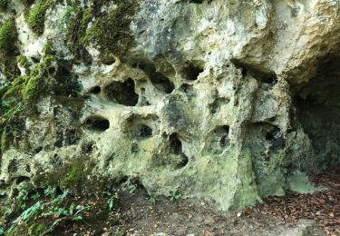
Le Tour de Barbiriacum Une boucle de 11 km, avec 500 m de dénivelé, partant de la mairie de Barbirey-sur-Ouche. Bel itinéraire fort bien balisé avec quelques centres d'intérêt méritant le déplacement. Une randonnée du Club Alpin Français de l'Ouest Dijonnais. « Si tu veux aller un peu plus loin, avec le CAFOD tu feras des randonnées pas comme les autres» ! Avertissement : Les itinéraires mentionnés ici ne sont pas vérifiés (droit de passage, accidents de terrain, etc...). Par conséquent, il convient avant le départ de se renseigner sur la faisabilité du circuit envisagé.

Elevation profile

Photos

Positioning

Country:
France
Region :
Bourgogne-Franche-Comté
Department/Province :
Côte-d'Or
Municipality :
Barbirey-sur-Ouche
Location:
Unknown
Start:(UTM)
632830 ; 5234766 (31T) N.

Comments

Please log in to post a review or rate the element


Trails nearby

Trail Walking Sainte-Marie-sur-Ouche - Pont de Pany - Photo
Walking
hueco

Walking

Easy
(1)
Sainte-Marie-sur-Ouche, Bourgogne-Franche-Comté, Côte-d'Or, France
11.4 km | 16 km-effort
3h 19min
Yes
Trail Walking Sainte-Marie-sur-Ouche - Belvédères sur la vallée de l'Ouche - Pont de Pany - Photo
Walking
tracegps

Walking

Difficult
(1)
Sainte-Marie-sur-Ouche, Bourgogne-Franche-Comté, Côte-d'Or, France
20 km | 28 km-effort
6h 0min
Yes
Trail Walking La Bussière-sur-Ouche - La Bête de l'Auxois - La Bussière sur Ouche - Photo
Walking
tracegps

Walking

Difficult
(1)
La Bussière-sur-Ouche, Bourgogne-Franche-Comté, Côte-d'Or, France
25 km | 33 km-effort
6h 0min
Yes
Trail Walking Grenant-lès-Sombernon - Grenant les sombernon  - Photo
Walking
eric.guyard21

Walking

Grenant-lès-Sombernon, Bourgogne-Franche-Comté, Côte-d'Or, France
14 km | 21 km-effort
3h 35min
Yes
Trail Walking La Bussière-sur-Ouche - Pierre du druide , grotte de tebsima - Photo
Walking
eric.guyard21

Walking

Medium
La Bussière-sur-Ouche, Bourgogne-Franche-Comté, Côte-d'Or, France
15.9 km | 23 km-effort
3h 32min
Yes
Trail Walking Saint-Jean-de-Bœuf - Saint JeandeBoeuf-Gissey sur Ouche - Photo
Walking
mpstoop

Walking

Medium
Saint-Jean-de-Bœuf, Bourgogne-Franche-Comté, Côte-d'Or, France
22 km | 31 km-effort
8h 5min
Yes
Trail Walking Gergueil - balcon de l'Ouche - Photo
Walking
mpstoop

Walking

Very difficult
Gergueil, Bourgogne-Franche-Comté, Côte-d'Or, France
38 km | 50 km-effort
9h 28min
No
Trail Walking Barbirey-sur-Ouche - Tebzima - Photo
Walking
dominiq

Walking

Medium
Barbirey-sur-Ouche, Bourgogne-Franche-Comté, Côte-d'Or, France
13.4 km | 20 km-effort
4h 11min
Yes
Trail Walking Fleurey-sur-Ouche - Roche d Anse 23/11/11 - Photo
Walking
ludojiel

Walking

Easy
(1)
Fleurey-sur-Ouche, Bourgogne-Franche-Comté, Côte-d'Or, France
8.8 km | 12.4 km-effort
2h 20min
Yes


Close
My subscriptions